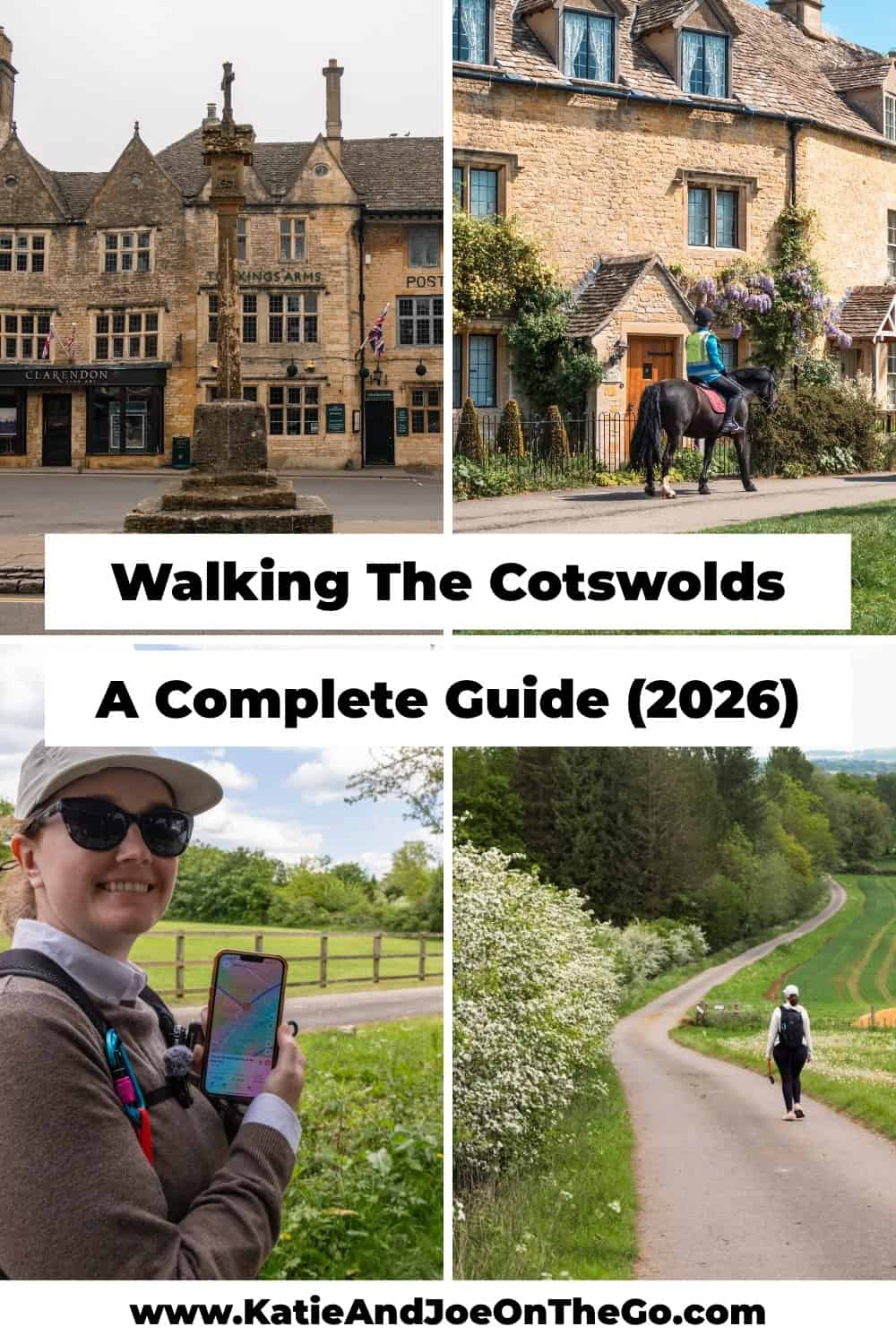
Walking the Cotswolds: A Complete Guide (2026)
We spent two weeks walking the Cotswolds this spring as part of a self-guided tour through England, and it quickly became the highlight of our entire trip. After days on the trail, wrong turns through farmers’ fields, and more miles than we expected, we put together what we think is the most honest and practical guide to walking the Cotswolds you’ll find.
Are you looking for the best Cotswolds walks to add to your England trip? From stone-paved paths connecting medieval villages to riverside trails through the prettiest countryside in England, walking the Cotswolds is one of those experiences that genuinely lives up to the hype.
In this guide, we are sharing everything you need to plan your own Cotswolds walking trip. We’ll cover the best day walks in the region, how to choose between self-guided and supported options, what navigation actually looks like on the ground, and what to pack to make the most of every mile.
Whether you are planning a multi-day walking holiday or just want to add a day hike to your England itinerary, this guide has everything you need to get started.
Everything You Need to Plan Your Trip
- ✈️ Flights: We use Daily Drop to find the best flight deals and mistake fares.
- 🚂 Trains and Buses: We book all of our transportation through OMIO.
- 🚗 Car Rental: We use Booking.com to compare the best rates.
- 🏨 Hotels: We use Booking.com and VRBO to find the best accommodation for every trip.
- 🏢 Hostels: We use Hostelworld to find the best budget stays.
- 🗺️ Tours and Activities: We book all of our tours through GetYourGuide and Viator.
- 🛡️ Travel Insurance: We never travel without it, SafetyWing.
- 📱 eSIM: We use Saily for all of our data needs.
- 📚 Guidebooks: Rick Steves and Lonely Planet.
- 💳 Travel Credit Card: We use the Capital One Venture X for all of our travel purchases. It comes with automatic trip cancellation, lost luggage, and travel accident insurance built in.
Why Walking The Cotswolds Should Be On Your England Itinerary
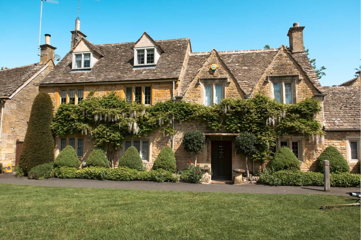
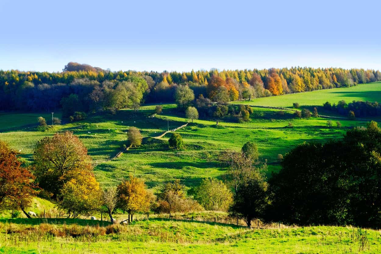
Walking the Cotswolds had been on our bucket list for years. The idea of roaming through some of England’s most beautiful scenery with a cozy inn waiting at the end of the day, a cold pint in hand, and a large plate of English fare on the table felt like the perfect trip. It lived up to every bit of that vision.
What surprised us most was how comfortable it felt. You are never truly far from civilization. You cross a road here and there, pass through a village every few miles, and always have a pub or tea room within reach. However, you are completely surrounded by nature for almost the entire time.
That balance is something we genuinely cannot find at home. Walking in American cities usually means a sidewalk squeezed against a busy road, if there is a sidewalk at all. Walking in a State or National Park often means you are 50 miles from the nearest town. The Cotswolds sits perfectly in between. Wild enough to feel like an escape, close enough to feel safe and supported.
If you are planning a trip to England and wondering whether to add the Cotswolds, the answer is yes. And if you are wondering whether to walk it rather than drive it, the answer is also yes. This is what the Cotswolds was made for.
Walking in England: What Makes It Different
One of the first things that surprised us about walking in England was how different it felt from anywhere we had walked before. The trails, the culture, and the etiquette are unlike anything you will find back home. Here is what you need to know before you go.
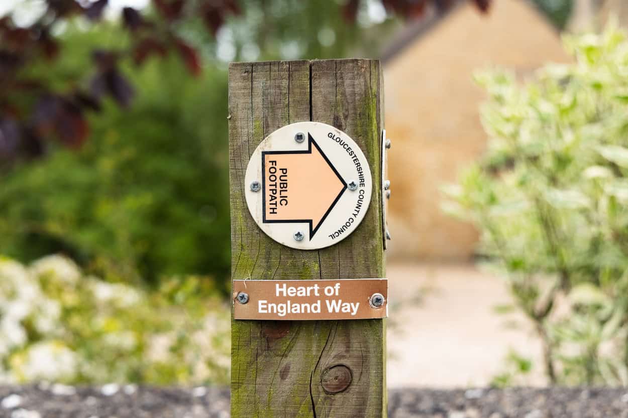
The Public Footpath System
Public footpaths have been woven into the fabric of English countryside for centuries. Many of the paths we walked had been used by locals for hundreds of years, and landowners are legally required to keep them accessible. England has some of the most famous long-distance walking routes in the world including Hadrian’s Wall Path, the South West Coast Path, and the Cotswold Way.
England is not just preserving its walking culture either. It is actively expanding it. In March 2026, King Charles III inaugurated the King Charles III England Coast Path, the world’s longest managed coastal walking route at 2,689 miles around a huge portion of England’s coastline. More than 1,000 miles of brand new paths were created to make it happen.
The Right to Roam: What It Means When Walking the Cotswolds
One of the most fascinating things about walking in England is the concept of the right to roam. In America, crossing onto someone’s private property is a serious matter. At best you get asked to leave. At worst it gets dangerous, fast. For the most part, England operates completely differently.
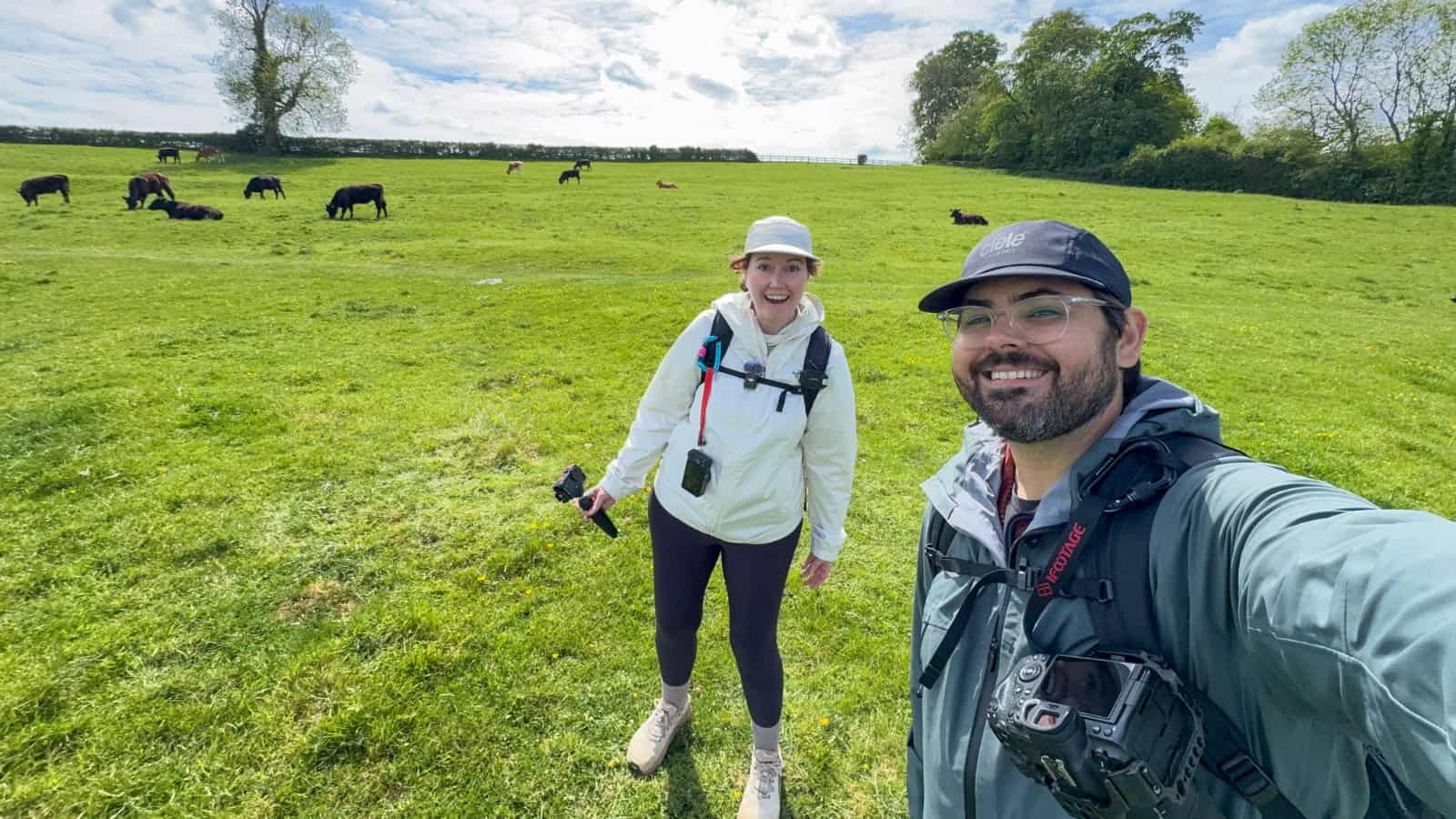
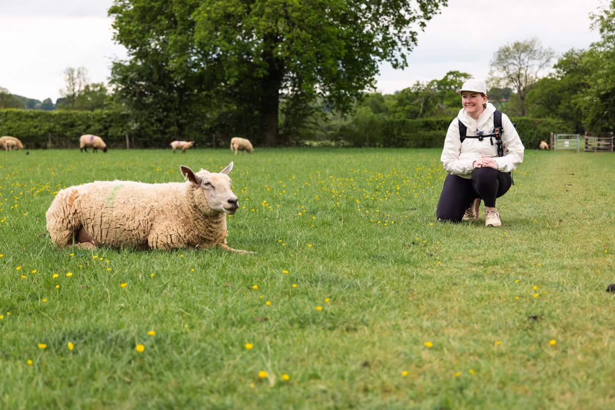
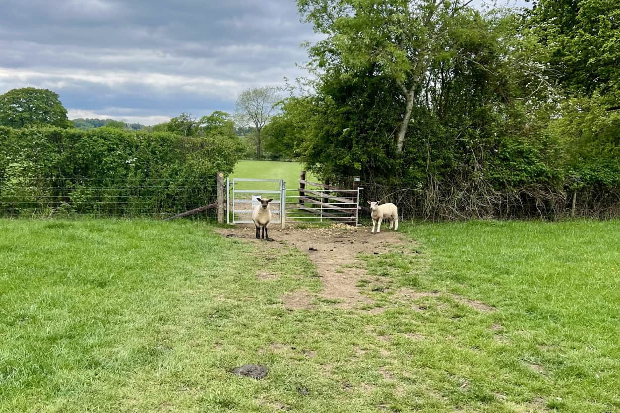
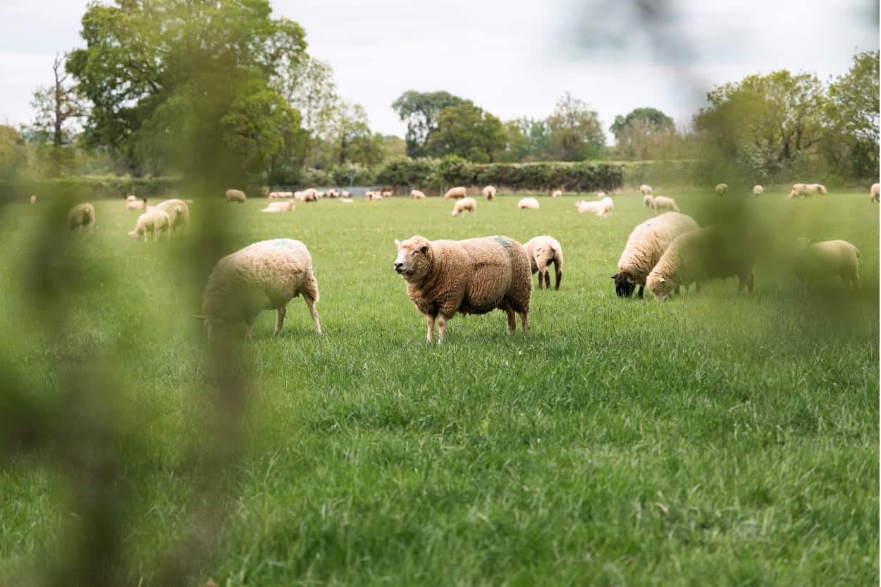
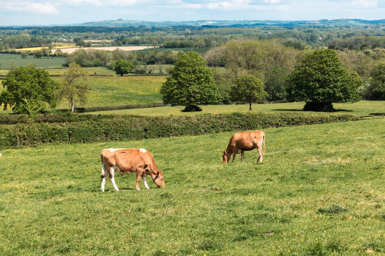
Public footpaths can take you directly through a working farm, across a field of sheep, or past someone’s back garden. Landowners are legally required to keep those paths accessible, even if they do not always love it. We walked through several herds of sheep and cows on our routes through the Cotswolds. It felt strange at first but after a few times, it felt completely normal.
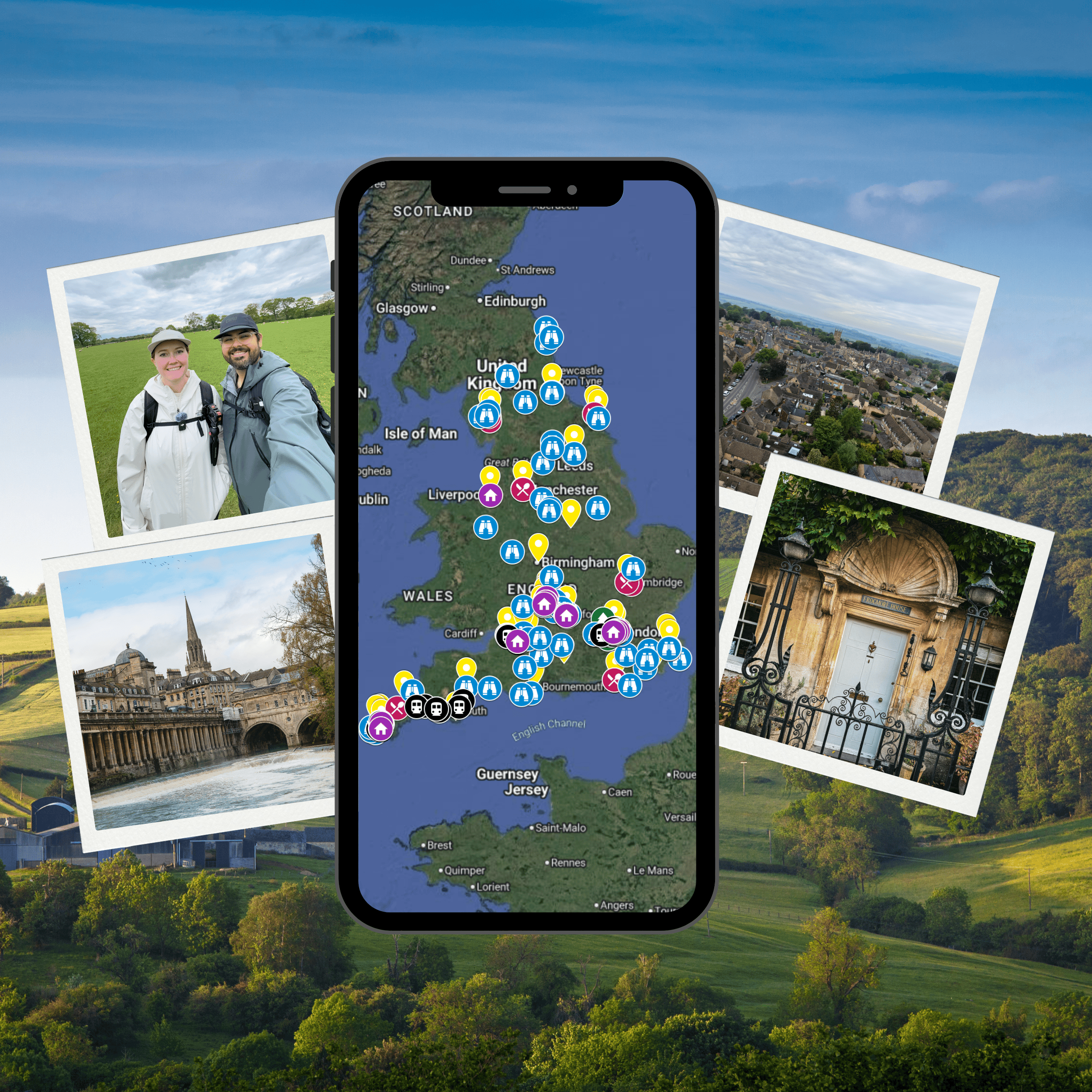
The Ultimate England Google Map
Planning a trip to England? We put together a custom Google Map with all of our favorite spots across the country, including everything we covered in this guide. Hotels, restaurants, attractions, hidden gems and more — all pinned and ready to go.
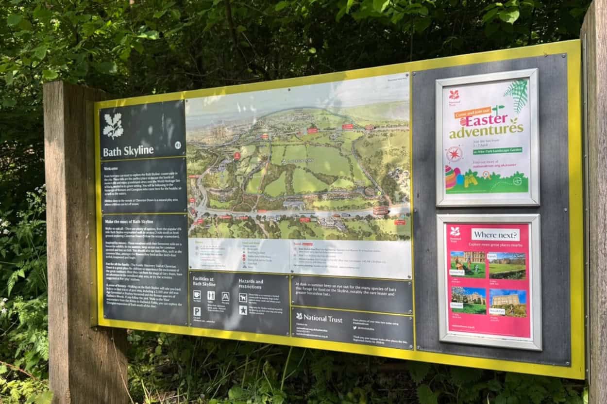
How Well Marked Are the Cotswolds Trails?
Walking the Cotswolds is generally well marked. Yellow arrows, wooden finger posts, and the National Trail acorn symbol appear regularly along the route.
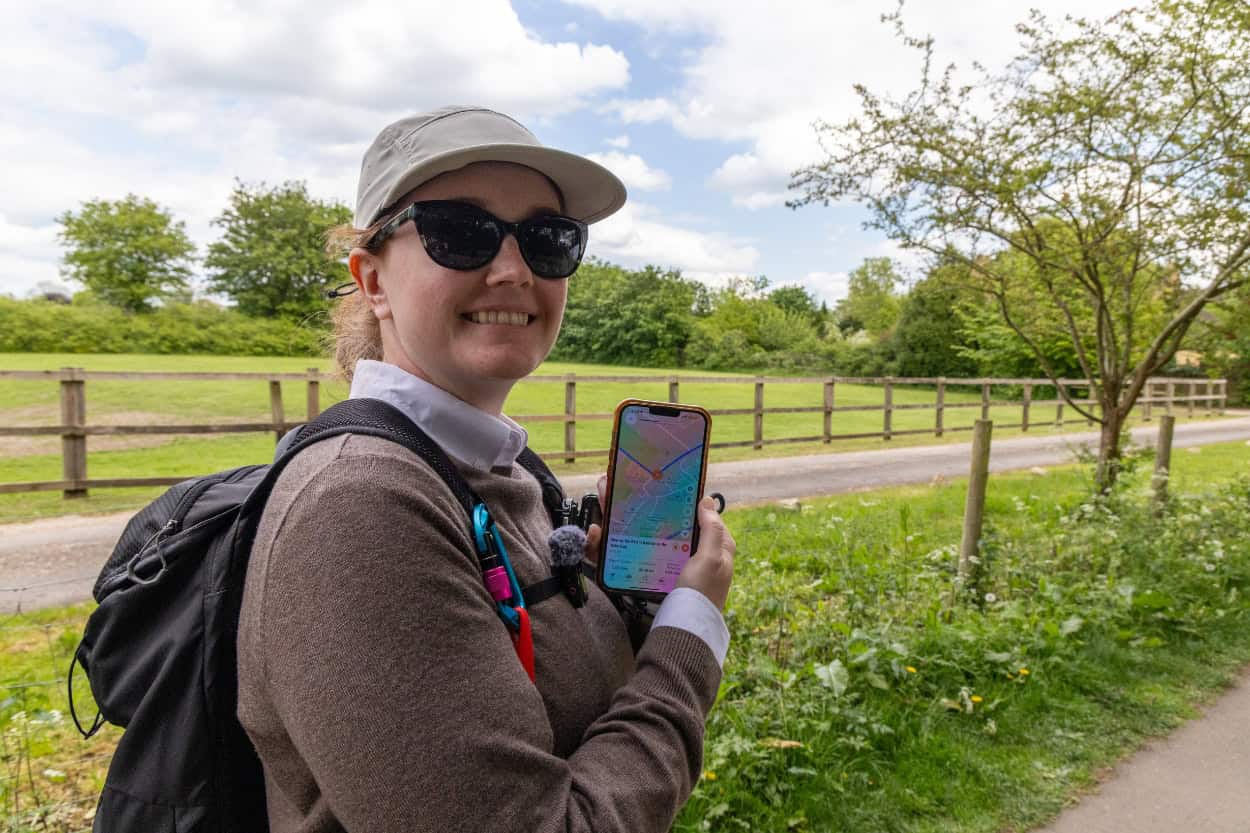
That said, we still got lost a handful of times. We had the Macs Adventure app on our phones and followed it extensively throughout our trip. However, even with navigation in hand, the trail would occasionally disappear on us.
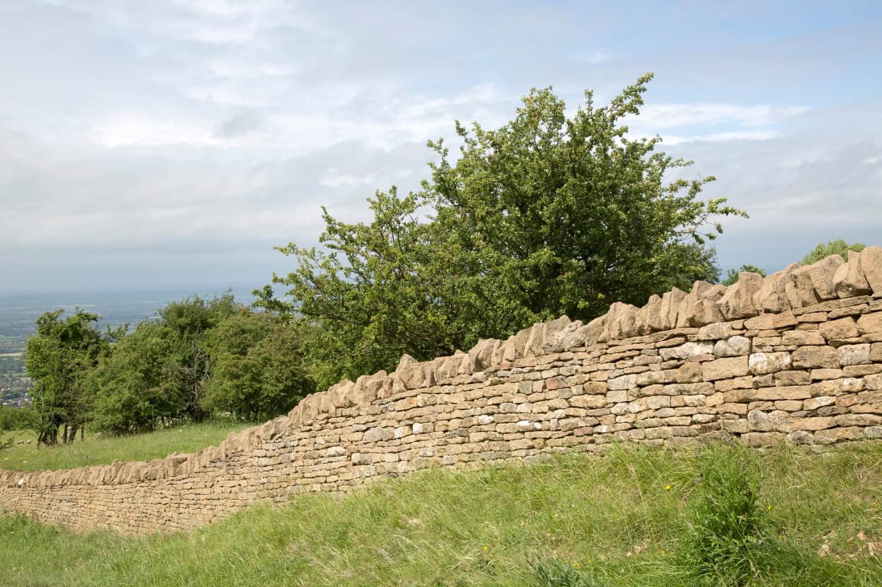
Most of the time this happened near farm boundaries. The good news is that most properties have a fence or stone wall surrounding them. If you lose the path, simply walk along the wall until you find a gate. Nine times out of ten that is exactly where the trail picks back up.
We were also a few weeks into spring when we walked, which helped more than we expected. Enough walkers had already been through ahead of us that a natural trail was ingrained into the grass. Following the worn path through an open field was often easier than checking the app.
The trickier moments came at water crossings and overgrown sections. There was always a bridge, but finding it was the challenge. The same goes for sections surrounded by unkempt, thorny bushes. You could technically push through, but you are going to have a bad time. Follow the boundary and find the proper crossing point.
Stiles, Kissing Gates, and Farmers’ Fields You’ll Encounter Walking the Cotswolds
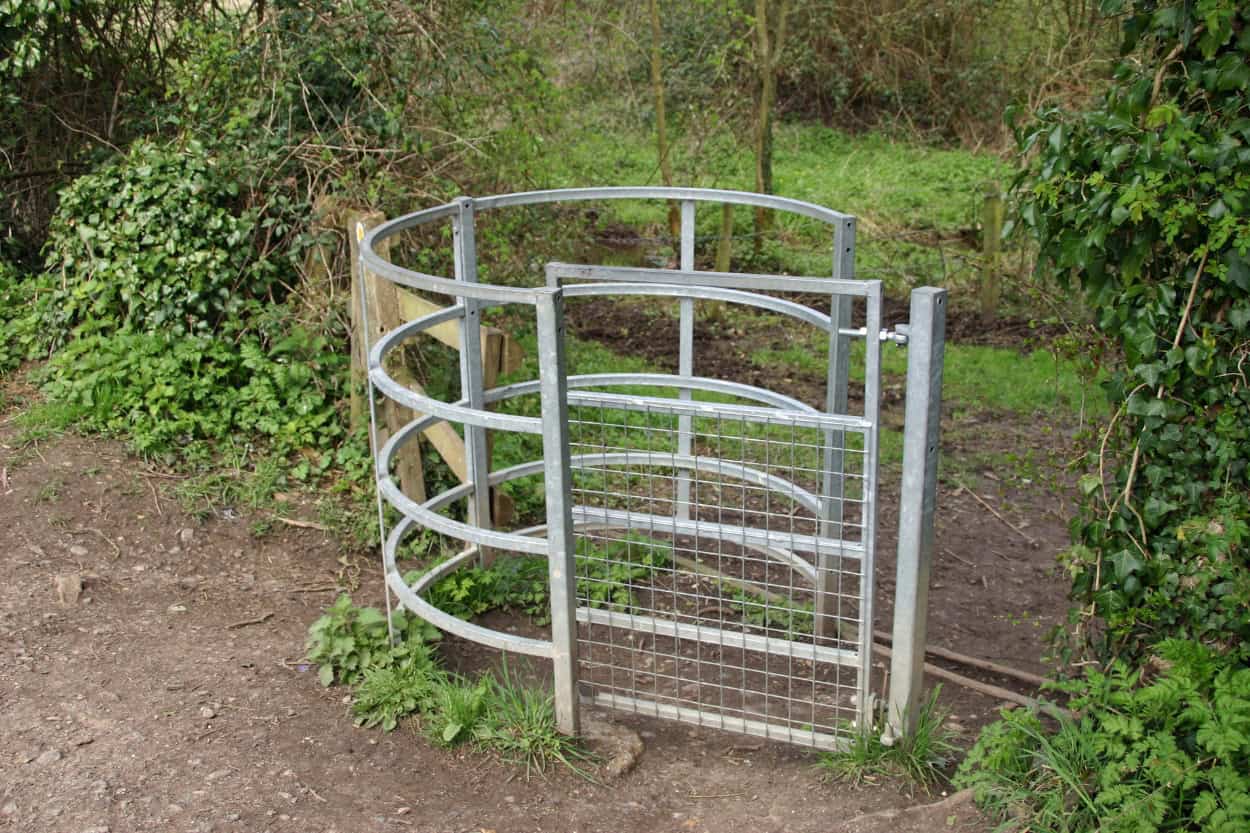
Walking the Cotswolds means encountering a whole vocabulary of trail features that most Americans have never seen before. Stiles, kissing gates, and farm gates are how the footpath system connects fields, villages, and private land.
A kissing gate is a small gate built in a U or V (shown below) shape that lets people through but keeps animals in. A stile is a step built into a fence or wall that lets you climb over without opening anything. We encountered every single type within the first hour of walking. It became a fun little challenge to figure out how each one worked. We took a video of Joey opening every gate style we came across on the trip. Highly recommend doing the same.
There is one rule that applies to every single gate you encounter on the trail, and it is not optional. Always leave gates exactly as you found them. If it was closed, close it behind you. If it was open, leave it open. This is not just trail etiquette. It is how farmers keep their livestock in the right field. Getting it wrong can cause real problems for the people whose land you are walking through.
You will also walk through active farmland. We walked through several herds of sheep and cows along our routes. The animals are generally unbothered by walkers. However, always give them space and never walk between a mother and her young.
One of our BnB host also mentioned that some farmers are not thrilled about walkers cutting through their land. A few will tip over or move trail signs to discourage it. If a sign suddenly disappears, do not take it personally. Follow the wall, find the gate, and keep moving.
The Cotswold Way vs. Day Hikes: Which Is Right for You?
One of the first decisions you will make when planning a walking trip to the Cotswolds is whether to tackle the full Cotswold Way, a section of it, or stick to day hikes. All three are great options. However, they offer very different experiences. Here is how to decide which is right for you.
The company that we used for our, Macs Adventure, offers multiple options depending on the amount of time you have, the pace you wan’t to keep, and what villages you want to explore. Here’s a list of the Cotswolds Tours here.
What Is the Cotswold Way?
The Cotswold Way is one of England’s official National Trails, a designation given to only a small number of routes across the country that meet the highest standards for signage, maintenance, and accessibility. It was formally recognized as a National Trail in May 2007 after years of lobbying by walking organizations. That designation matters because it means the trail is consistently well maintained and waymarked from start to finish.
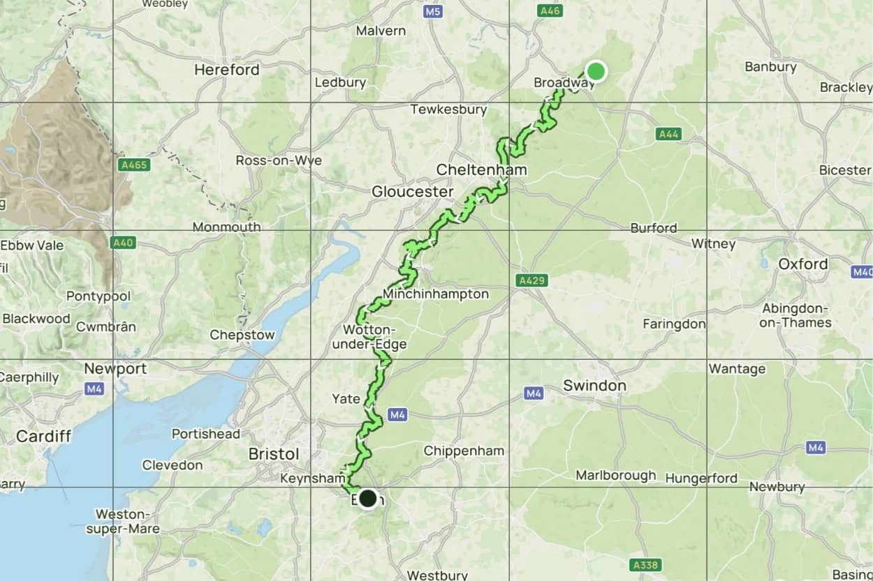
The trail stretches 102 miles from the market town of Chipping Campden in the north to the UNESCO World Heritage city of Bath in the south. For most of its length it follows the Cotswold escarpment, giving walkers sweeping views across the Severn Vale and the Malvern Hills.
Along the way the trail passes through some of the most iconic stops in the region. Here are the key stops along the route from north to south:
The North (Chipping Campden to Painswick)
- Chipping Campden: The official starting point, a stunning medieval market town with one of the most beautiful high streets in England.
- Broadway: One of the prettiest villages in the Cotswolds with a broad high street and strong Arts and Crafts history.
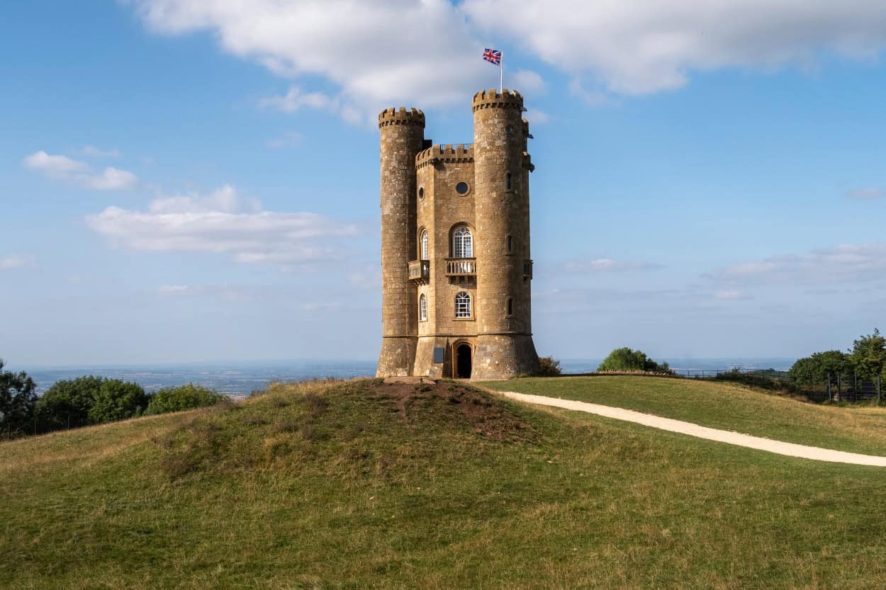
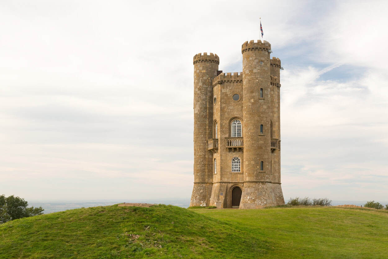
- Broadway Tower: One of the highest points in the Cotswolds with panoramic views across Worcestershire and the Malvern Hills.
- Stanton and Stanway: Two of the most unspoiled and photogenic villages on the entire trail.
- Winchcombe: A charming market town with medieval streets and nearby Sudeley Castle.
- Cleeve Hill: The highest point on the entire trail at over 1,000 feet.
- Cheltenham: A grand Regency spa town sitting just off the escarpment.
- Painswick: Known as the “Queen of the Cotswolds,” famous for its 99 yew trees at St Mary’s Church and the halfway point of the trail.

The South (Painswick to Bath)
- Stroud: A characterful market town set in a valley surrounded by five converging hills.
- Dursley: A quieter market town with great access to the escarpment and dramatic countryside views.
- Wotton-under-Edge: A historic market town on the southern edge of the Cotswolds.
- Hawkesbury Upton: A small village marking the entry into South Gloucestershire.
- Old Sodbury: A quiet village with an ancient hill fort nearby.
- Tormarton and Dyrham: Peaceful countryside villages with Dyrham Park, a stunning National Trust estate nearby.
- Cold Ashton and Lansdown: The final stretch of countryside before the trail descends into Bath.
- Bath: The grand finale, a UNESCO World Heritage city packed with Roman and Georgian history.
Why We Chose Day Hikes Over Walking the Full Cotswold Way
We came to the Cotswolds as part of a hosted trip with Macs Adventure, which gave us a taste of walking the region across several day hikes rather than the full Cotswold Way. Honestly, it was the perfect introduction.
Day hiking also gave us the freedom to explore towns that sit outside the Cotswold Way entirely. Moreton-in-Marsh, Stow-on-the-Wold, and Bourton-on-the-Water are all places we spent real time in. None of them sit directly on the Cotswold Way. Therefore, if you stick exclusively to the trail, you will miss some of the places that made this trip genuinely special for us.
That said, we would love to come back and walk the full Cotswold Way. The version we have our eye on is the Macs Adventure 12-day itinerary, which spreads the 102 miles over 10 walking days at an average of 10 miles per day. Fewer miles per day means more time to actually slow down and take it all in.
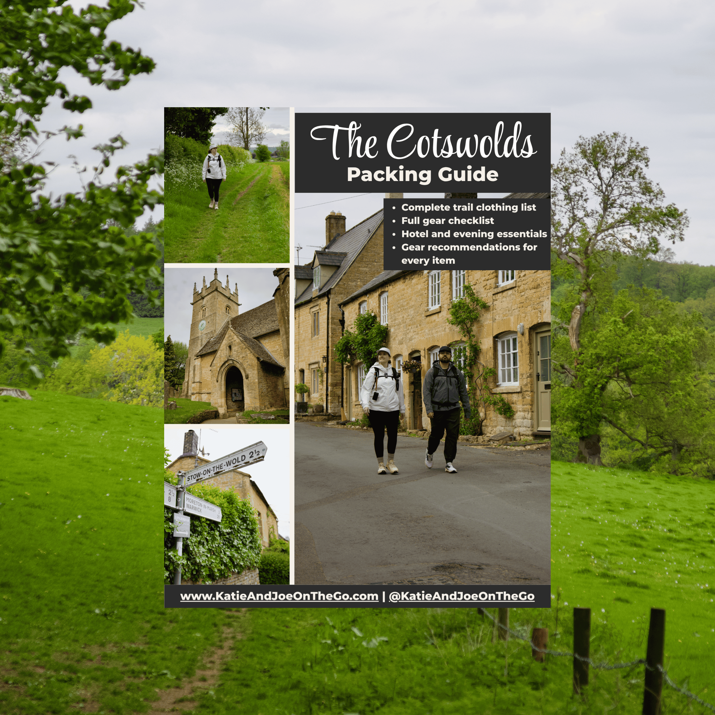
The FREE Cotswolds Packing Guide
Not sure what to pack for walking the Cotswolds? We put together a free packing guide covering everything you need on the trail and at the hotel, from merino wool base layers to the exact shoes we wore. Download it and show up prepared.
How to Mix Day Hikes and the Cotswold Way on One Trip
The good news is that you do not have to choose between the full trail and day hikes. There is a middle option that works really well for time-constrained travelers.
Macs Adventure splits the Cotswold Way into two halves. The Cotswold Way North runs from Chipping Campden to Painswick and takes 7 days. The Cotswold Way South runs from Painswick to Bath and is another 5 to 6 days of walking. If you cannot commit to the full 102 miles in one trip, you can walk the north one year and come back for the south the next. It is a great way to work within your schedule without feeling like you are cutting corners.
Furthermore, if you want an even shorter taste of the trail, several individual Cotswold Way stages work beautifully as standalone day hikes. Our walks between Moreton-in-Marsh, Stow-on-the-Wold, and Bourton-on-the-Water are a perfect example. Each one stands on its own. Together they give you a real feel for what walking the Cotswolds is all about.
How To Get To The Cotswolds
The Cotswolds is not a single town with one train station. It is a sprawling region, so how you get there depends on where you are starting from and what you are planning to do once you arrive. Here is what worked for us and what we recommend.
Getting to the Cotswolds by Train
We started our England trip at London Heathrow, spent a few days exploring Oxford (check out our full guide on Oxford, England here), and from there, Moreton-in-Marsh was just a 30-minute train ride away. It was genuinely one of the smoothest travel days we have had. One minute we were walking cobblestone streets in Oxford, and the next we were stepping off a train into the heart of the Cotswolds.
Depending on where you are coming from, you have several great options. If you are starting the Cotswold Way at its official northern beginning in Chipping Campden, plan for a short bus or taxi ride from Moreton-in-Marsh to get there. Chipping Campden does not have its own train station, so Moreton-in-Marsh is your closest rail connection.
If you are walking the trail in reverse and starting in Bath, trains from London Paddington run directly to Bath Spa in about 1.5 hours. Furthermore, if you are flying into Heathrow and heading straight to the Cotswolds, you can connect directly without ever needing to go through central London.
Ready to book your journey? Here are the more popular routes:
- London Paddington to Chipping Campden
- London Paddington to Moreton-in-Marsh
- London Paddington to Bath
- London Heathrow to Moreton-in-Marsh

Getting to the Cotswolds by Car
Driving gives you the most flexibility between villages and is a popular choice for visitors who want to explore at their own pace. The Cotswolds sits roughly two hours northwest of London by car, with the M40 being your main route from the city connecting to the A44 into the heart of the region.
However, if you are planning a multi-day walking trip, a car creates a logistical headache. You will need to figure out how to get back to it at the end of each day. For circular day hikes this is less of an issue.
For point-to-point walking, the train is almost always the simpler and more stress-free choice.
Getting to the Cotswolds by Private Tour
Walking the Cotswolds may not be attainable for everyone, and that is completely fine. This region is too beautiful to miss just because a multi-day walk does not fit your plans. From London, several excellent guided day tours take you through the highlights of the region in a single day without a single mile of walking required.
These are two tours worth checking out:
- Cotswolds Small Group Day Tour from London
- 7 Unmissable Cotswolds Stops Small-Group Tour
- Cotswolds Small Group Day Tour From Bath
Both are a fantastic way to experience the honey-colored villages, rolling hills, and iconic countryside that make this part of England so special. Sometimes the best way to fall in love with a place is simply to show up and let someone else handle the details.
Getting to the Cotswolds from the US
Most American travelers will fly into London Heathrow, which is your best gateway into the Cotswolds. The good news is that you do not need to spend a night in London first.
We flew into Heathrow, spent a few days exploring Oxford, and then jumped on a 30-minute train straight into Moreton-in-Marsh. Seamless from start to finish. If you are planning a similar route, check out our full guide on what to do in Oxford to help plan that leg of the trip before heading into the Cotswolds.
Insider Tip
We book all of our European transportation through OMIO. It compares trains, buses, flights, and ferry tickets all in one place. No switching between apps, no guessing which operator is cheapest. It is hands down the easiest way to get around Europe.
Best Cotswolds Walks by Village and Town
We explored the Cotswolds as hosted guests of Macs Adventure on their Cotswolds to Cornwall Coast self-guided tour. Every walk was planned for us in advance. Each morning we stepped outside, opened the Macs Adventure app, and simply followed the route.
No logistics, no stress, no heavy pack. Our luggage was collected from our accommodation each morning and was waiting for us at our next stop by the time we arrived. All we had to carry was a daypack with water, snacks, and our camera gear.
It is honestly one of the best ways to experience walking the Cotswolds. However, if you are planning your own route independently, both AllTrails and the National Trail website are excellent resources for finding and following walks throughout the region.
The walks below are the routes we covered during our time in the Cotswolds. For each one we have included distance, difficulty, and what to expect on the ground so you can decide which ones are right for you.
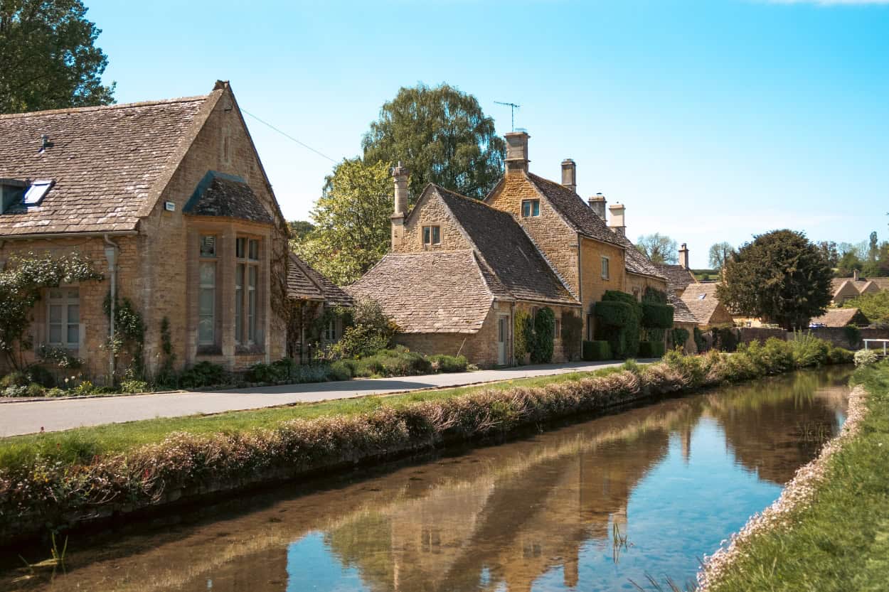
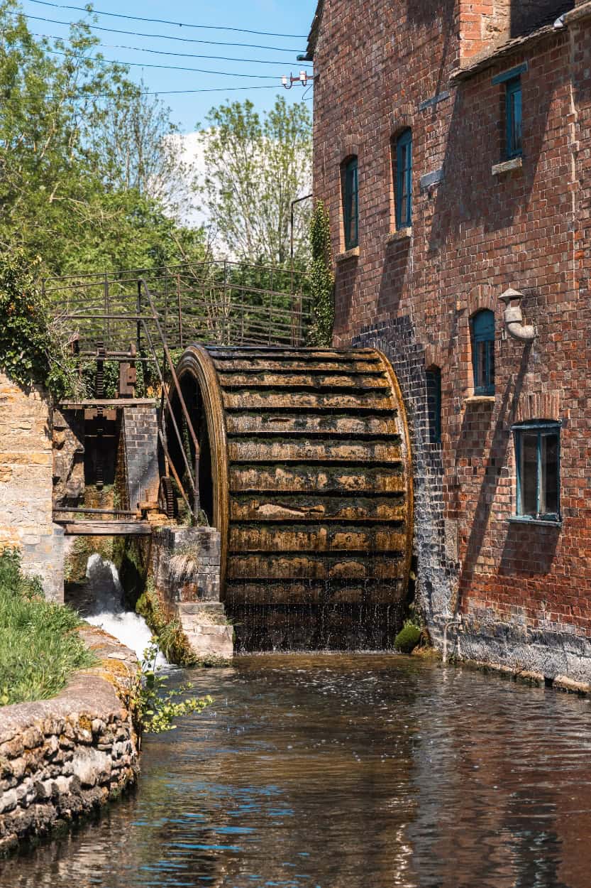
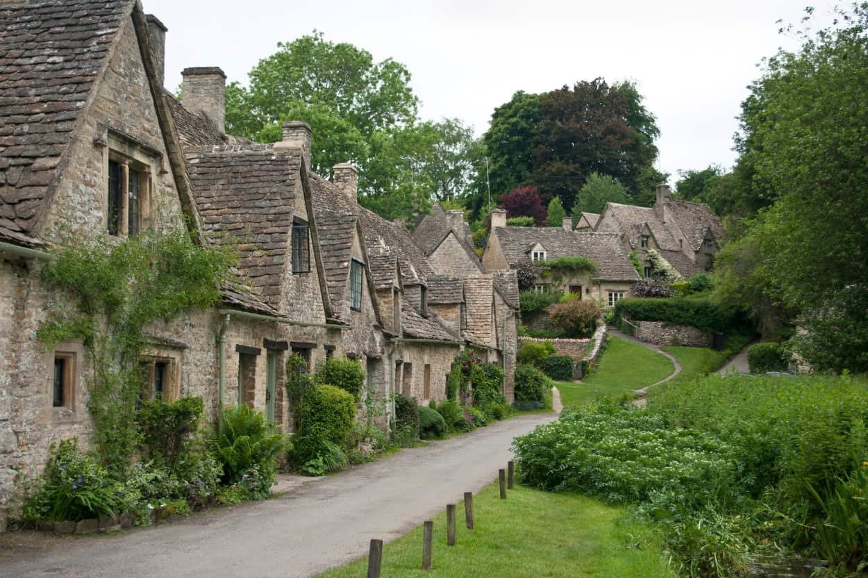
Walking Near Moreton-in-Marsh
Moreton-in-Marsh is one of the best bases for walking the Cotswolds. It sits right on the main rail line, making it easy to reach from Oxford or London, and the surrounding countryside is exactly what you picture when you imagine walking in England.
We arrived by train from Oxford, found coffee at Grouch Coffee, sorted our laundry at The Laundrette, dropped our bags at the hotel (we stayed at the White Hart Royal Hotel and it was perfect), and headed straight out onto the trail. No wasted time. That is the beauty of Moreton-in-Marsh.
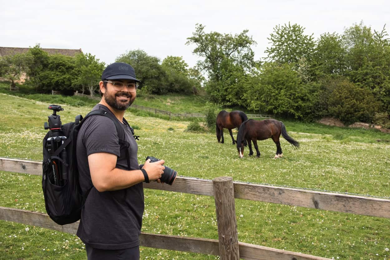
Batsford Arboretum and Sezincote Circular
Distance: 6 miles | Difficulty: Easy | Est. Time: 2 hours (allow more)
This was our very first walk in the Cotswolds and it could not have been a better introduction. The terrain is gentle throughout. Slow slopes, wide open fields, and easy paths that ease you in without any real challenge. It was exactly what we needed to get our legs moving after a few days of sightseeing.
This walk also threw every type of gate at us within the first hour. Kissing gates, stiles, farm gates, we encountered them all. It became a fun little challenge figuring out each one. We even have the videos to prove it.
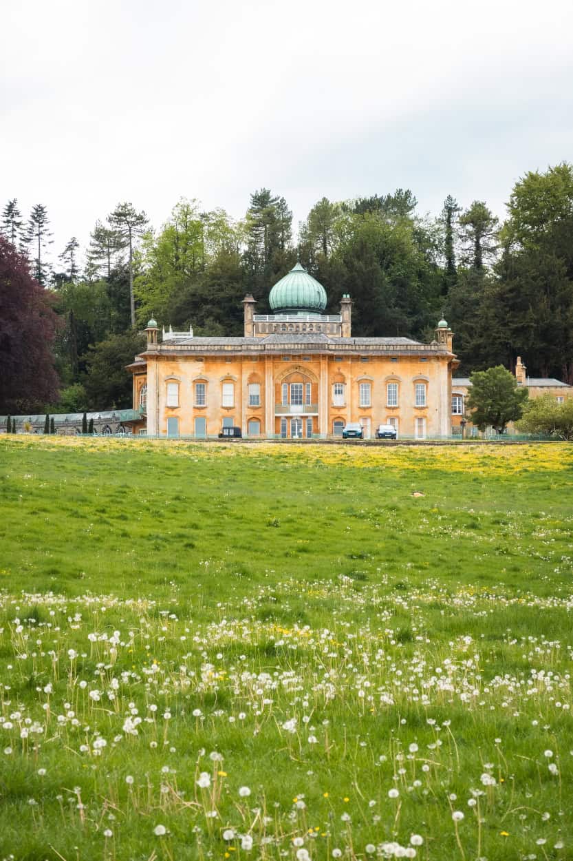
The highlight of the route is Sezincote House (photo above), one of the most unexpected sights in England. Built in 1805, it is the only authentically Mughal palace in northern Europe, complete with copper onion domes, minarets, peacock-tail windows, and sweeping water gardens. It feels completely out of place in the Cotswold countryside and yet somehow completely at home. When the Prince Regent visited in 1807, he was so impressed he went on to redesign the Brighton Pavilion in a similar style.
This route does not have an exact AllTrails match. However, the Moreton-in-Marsh and Longborough Circular covers similar countryside with just under 1.5 extra miles if you want a longer version.
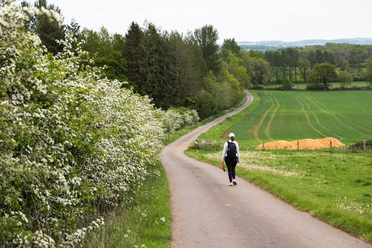
Moreton-in-Marsh to Stow-on-the-Wold
Distance: 6.6 miles | Difficulty: Easy to Moderate | Est. Time: 3.5 hours (allow 5)
This was our first inn-to-inn walking day and we had one goal: leave Moreton-in-Marsh and make it to Stow-on-the-Wold. Simple enough. However, we did not quite get the early start we had planned.
Back home when we hike, we try to be on the trail by 8am. Here in the Cotswolds, that plan fell apart the moment we saw the breakfast menu and knew that it was included in the cost of our room. Delicious English breakfast and French toast, served from 8am onwards. Therefore, after a proper sit-down morning meal, we did not set foot on the trail until closer to 10am. Our Macs App said the walk would take around 3.5 hours. We arrived in Stow-on-the-Wold at 3pm. Roughly 5 hours of walking, stops included. Adjust your expectations accordingly and just enjoy it.
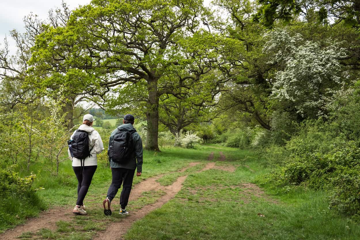
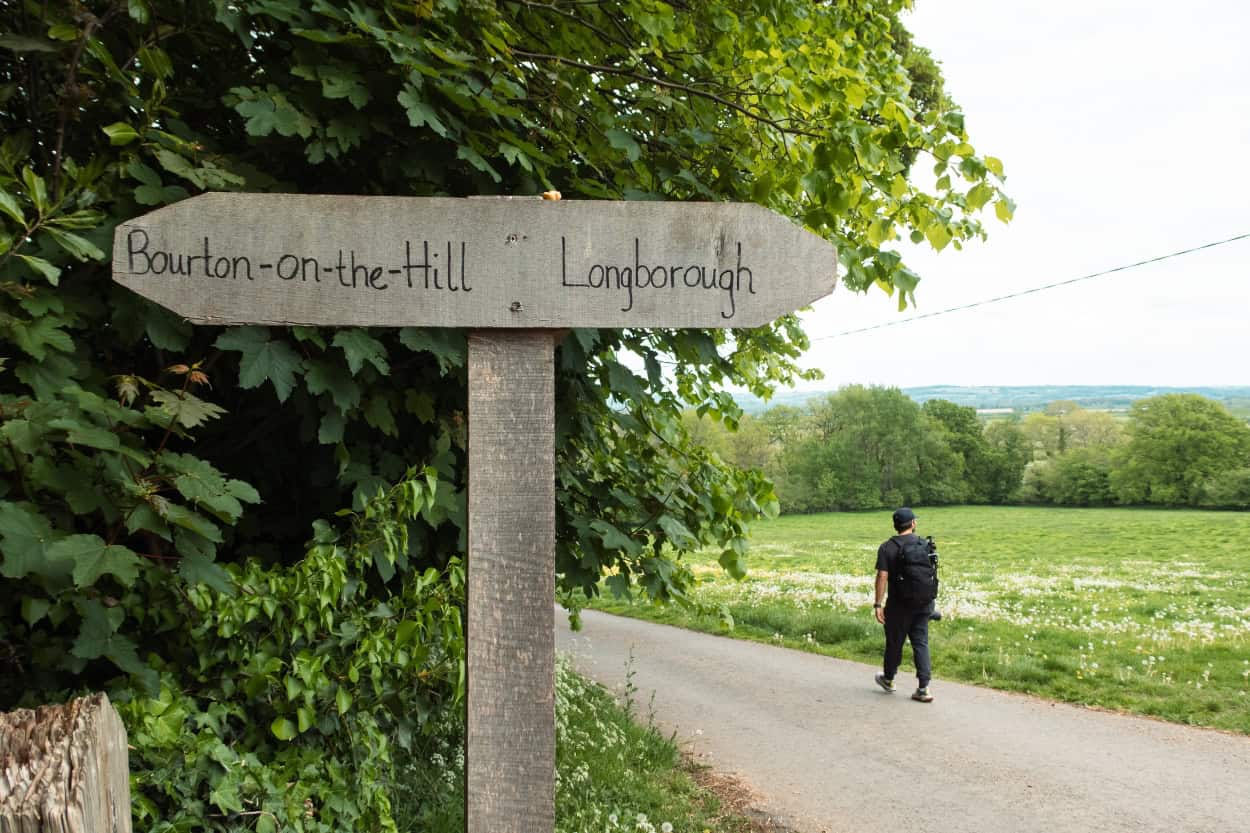
Through Longborough and Into the Countryside
First stop was Longborough, a quiet village of honey-colored stone homes that feels completely untouched by time. St James Church had a sign out front welcoming walkers to use the facilities, a small but genuinely appreciated gesture after a few miles on the trail. The Longborough Village Shop and Cafe became one of our favorite moments of the entire trip. We grabbed two savory pastries and cold sodas and ended up in a long conversation with one of the staff, a retired music professor from Stanford who had moved here with his wife. Only in the Cotswolds.
It was also here that we met three fellow walkers on the same Macs Adventure trip, just on a different schedule. We would cross paths with them on trails and at inns multiple times throughout the week. That kind of connection is one of the unexpected joys of walking inn-to-inn.
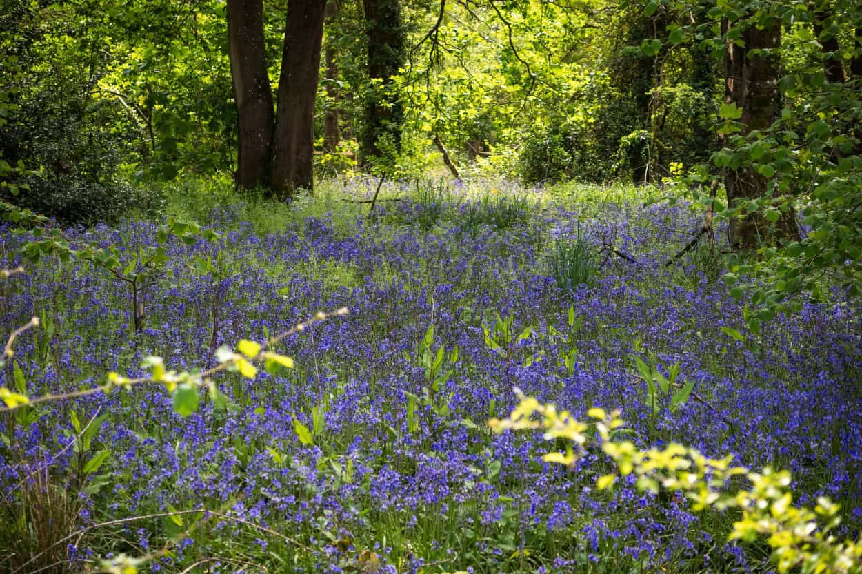
Further along, a section of the route was blocked due to construction. Therefore, we followed an alternative footpath that circumnavigated a working farm and dropped us into a shaded field full of English bluebells. It was one of the most beautiful moments of the entire trip and we never would have found it without the detour.

The Final Stretch into Stow-on-the-Wold
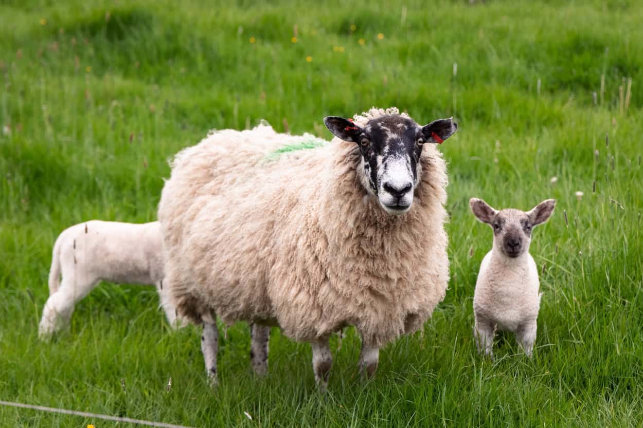
The fields between Longborough and Donnington were full of sheep, including more baby lambs than we could count. Next came Donnington, and then a stop at St Pauls Church where we ducked inside for a look at the interior. We do not go to church back home often, but in Europe we walk into almost every one we pass. The architecture and history are simply too good to walk past.
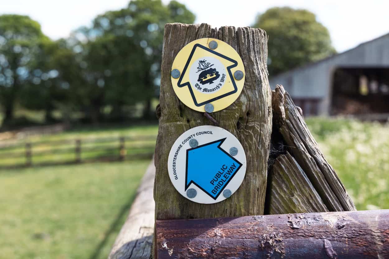
We also discovered partway through that we were briefly on the Monarch’s Way, a 625-mile long-distance trail that traces the escape route of King Charles II after his defeat at the Battle of Worcester in 1651. It is the longest inland trail in England and passes through two World Heritage Sites and a National Park. Finding out mid-walk that you are treading the same path as a fleeing king adds a certain something to the day.
The final stretch climbs steadily into Stow-on-the-Wold, which sits at around 800 feet and is one of the highest towns in the Cotswolds.
Our Experience: We arrived in Stow-on-the-Wold to find the three women we had met in Longborough standing outside our inn without a room. There had been a mix-up with their booking. We had a larger room that could sleep three, so we swapped with them and took a smaller room instead. You cannot leave fellow walkers out on the street, that is just not how it works out here.
Find the full route on AllTrails here.

The FREE Cotswolds Packing Guide
Not sure what to pack for walking the Cotswolds? We put together a free packing guide covering everything you need on the trail and at the hotel, from merino wool base layers to the exact shoes we wore. Download it and show up prepared.
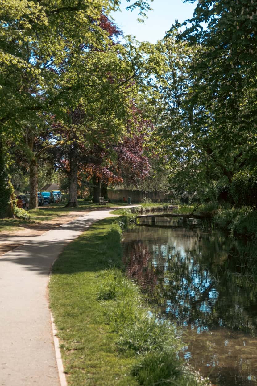
Walking Near Stow-on-the-Wold
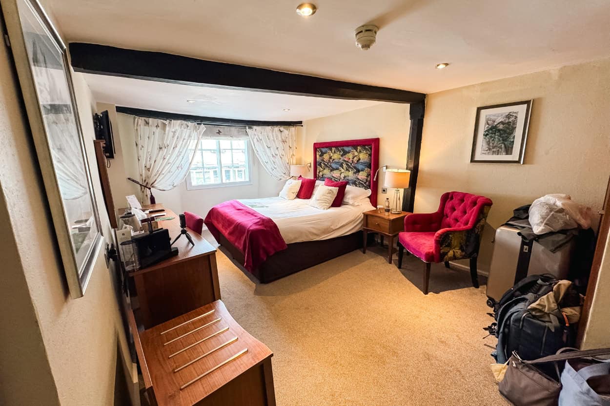
Stow-on-the-Wold sits at around 800 feet and is one of the highest and most beautiful market towns in the Cotswolds. It makes a fantastic base for day hiking, with some of the best walking in the entire region right on its doorstep. We stayed at The Bell Hotel and could not have asked for a better home base.
More on where to stay in Stow-on-the-Wold in our accommodation section below.
Stow-on-the-Wold to Bourton-on-the-Water Loop
Distance: 9.4 miles | Difficulty: Easy | Est. Time: 4-5 hours
This was our longest day of walking in the Cotswolds and one of the most rewarding. Our route took us south out of Stow-on-the-Wold, through Lower Slaughter, Bourton Chase, and into Bourton-on-the-Water before retracing our steps back to Stow.
It ran slightly longer than the AllTrails version (linked here), but the core loop is the same. If you book through Macs Adventure, their app will load the full route for you automatically. Otherwise the AllTrails link is your best starting point.
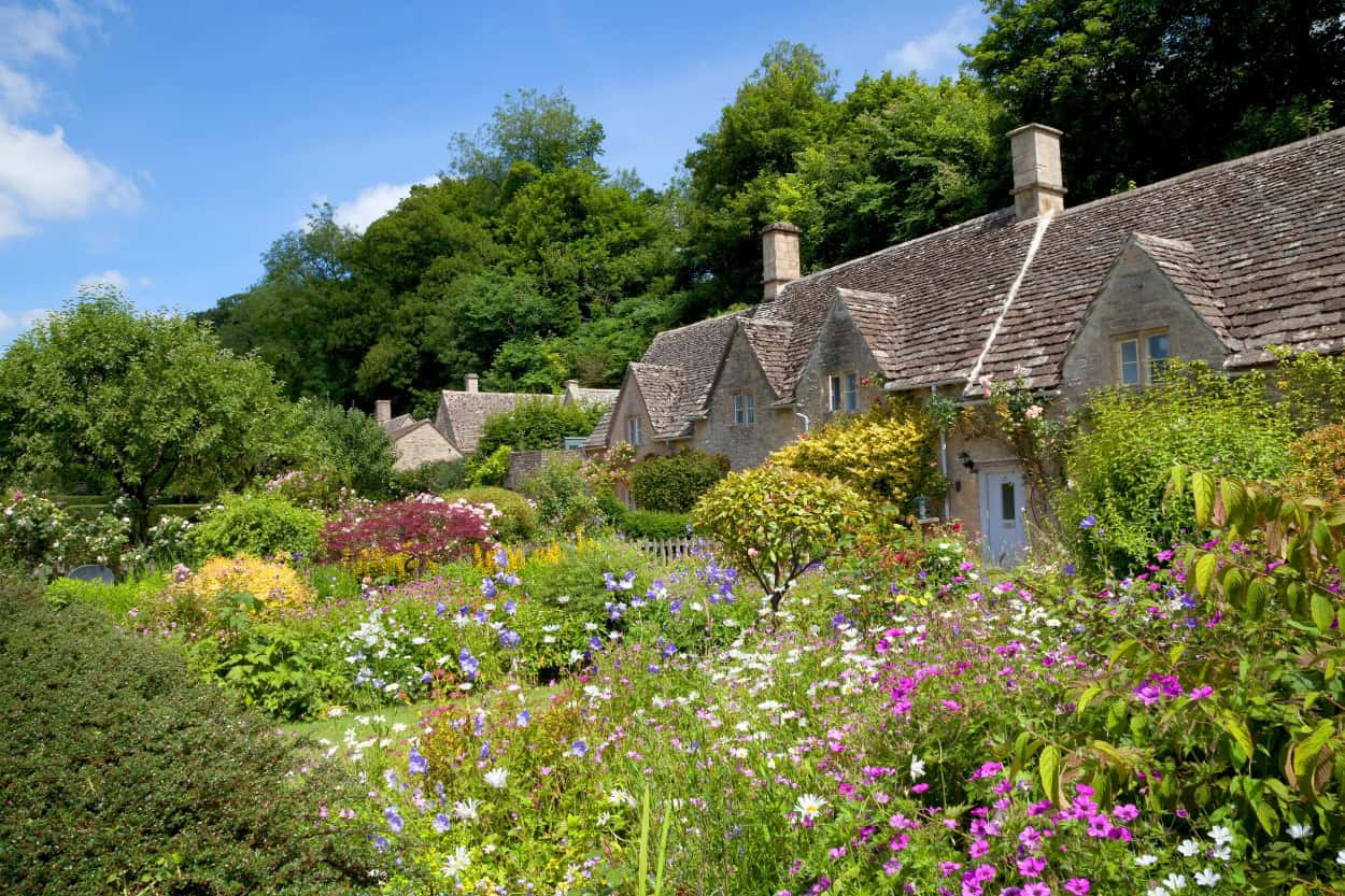
Lower Slaughter
You know the saying “don’t judge a book by its cover.” Well, the town of Lower Slaughter is not what you would imagine from the name.
However, step inside and it is one of the most picturesque villages we have ever walked through. Stone bridges cross a babbling creek, horses wander through the water, and honey stone buildings stretch as far as the eye can see.
Furthermore, it is ranked as one of the most beautiful villages in all of England and after walking through it ourselves, we can easily see why.
Just outside the village we stopped at Hawkstone Brewery for a well-earned break. Katie discovered what she will tell you is the freshest strawberry milk she has ever tasted, dispensed from an actual vending machine right there at the brewery.
You put a cup in and it fills it with fresh strawberry milk on the spot. So fresh, in fact, that it tasted nothing like the Nesquik she was expecting. Genuinely one of the more unexpected highlights of the entire trip.
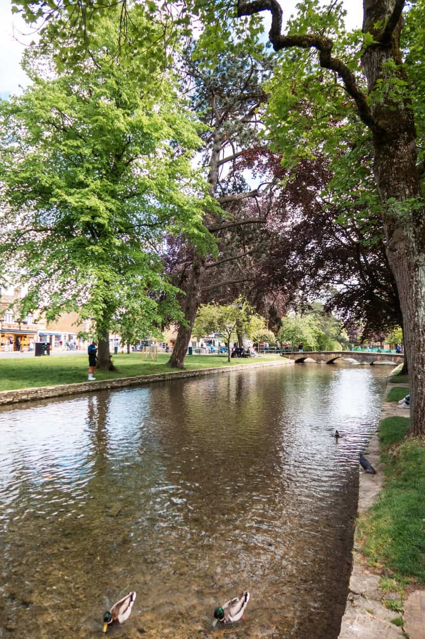
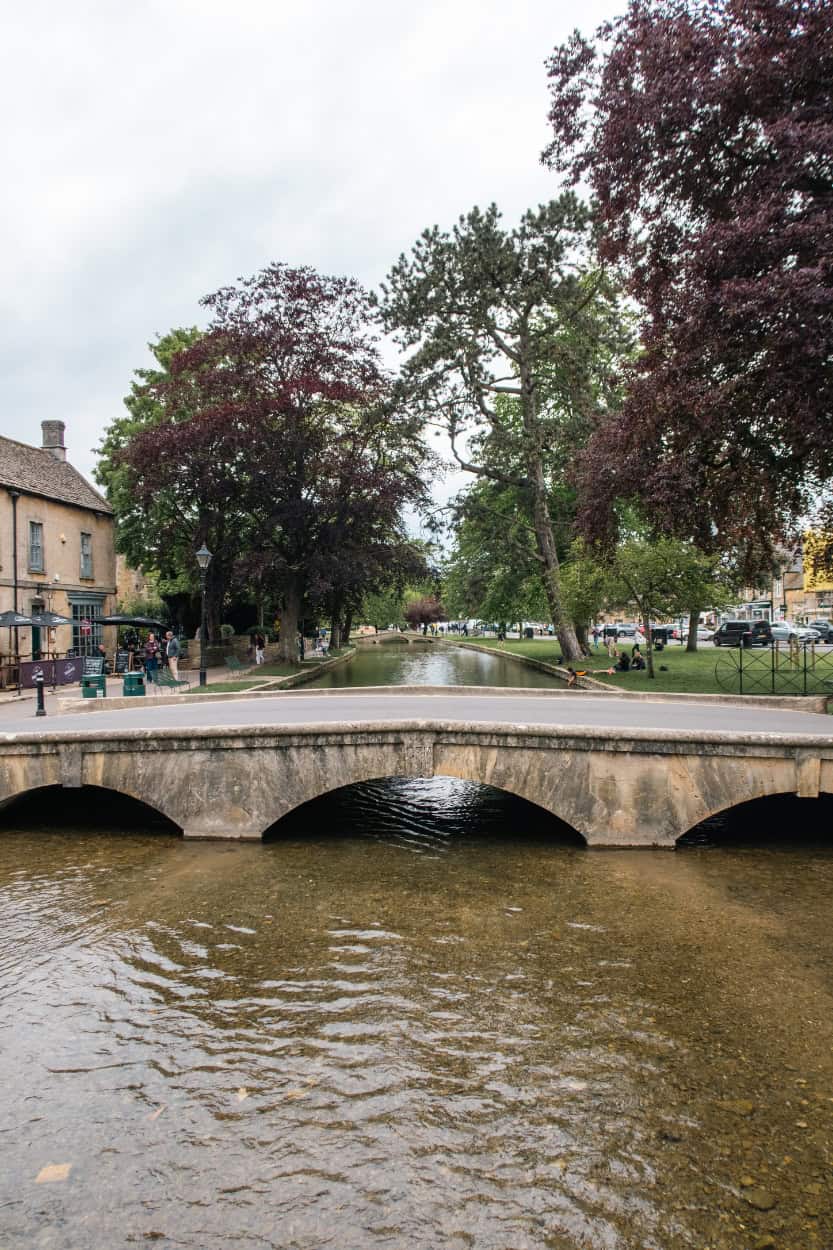
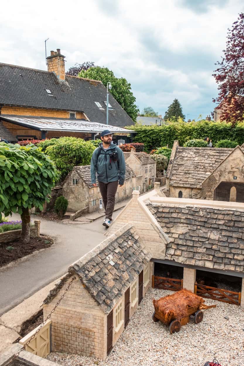
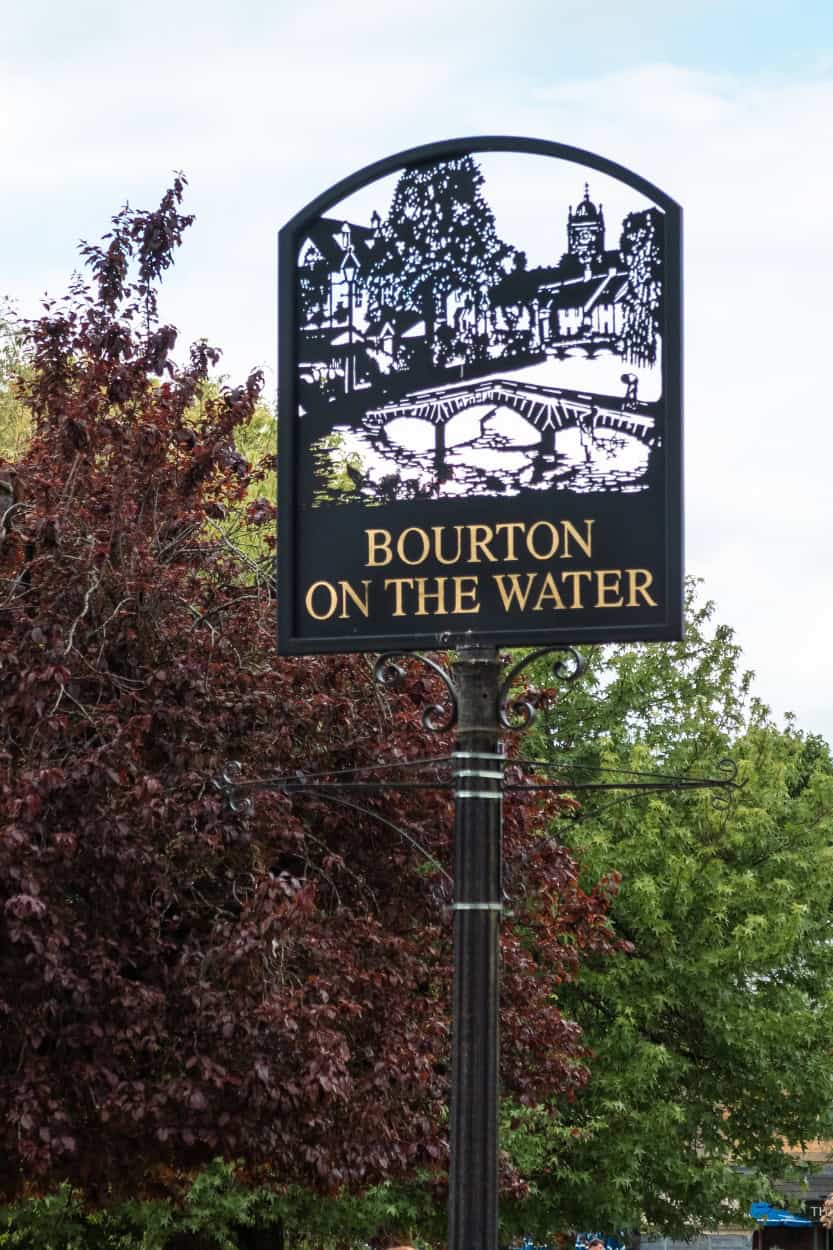
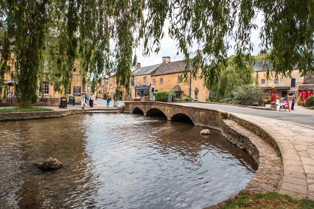
Bourton-on-the-Water
Bourton-on-the-Water had been on our radar long before we knew exactly where it was. It had hit our Instagram algorithm more than once and we finally got to see it in person. It lived up to every photo.
We wandered around for a few hours and made two stops worth highlighting.
First was the Cotswold Motoring Museum, where we walked through a fascinating collection of vintage cars and discovered BRUM, a beloved English children’s TV show built around a small vintage car. With one of the catchiest theme songs we’ve ever heard (listen here, trust us).
Second was The Model Village, a scaled down replica of Bourton-on-the-Water itself that you can actually walk around. As self-proclaimed anime nerds, we immediately saw the Attack on Titan potential and got the full Godzilla-terrorizing-the-micro-town POV shot. We’re nerds, remember?
Here is the part that made us laugh: there is also a model of the model village inside the model village. Therefore, technically, we were standing in a model of a model of the place we were already standing in.
We love quirky stops like this, they are always so much fun.

Getting Back to Stow-on-the-Wold
By the time we finished exploring Bourton-on-the-Water, the day was getting late. We quickly realized we were not going to make it back to Stow-on-the-Wold on foot before dark.
However, that is perfectly fine because there is a bus. The 801 Pulhams bus runs between Bourton-on-the-Water and Stow-on-the-Wold (here’s the full schedule) and is your backup plan if your legs give out or the day runs away from you.
We waited around 40 minutes and there was quite a queue by the time it arrived. The bus ran late with no update on the website. However, the Pulhams app does let you track buses in real time so you can see exactly where it is on the route. That feature saved our sanity.
Our Experience: We do not consider taking the bus a failure. We consider it smart planning. The Cotswolds rewards walkers who slow down, explore, and do not watch the clock. Sometimes that means the bus gets you home. That is what the bus is there for.
The Stow-on-the-Wold to Bourton-on-the-Water loop is one of the best day walks in the entire Cotswolds. It has everything. Stunning villages, unexpected detours, a model village with a model of itself, and a bus home when you need it.
Walking Near Bourton-on-the-Water
Bourton-on-the-Water sits at the center of some of the best walking in the entire Cotswolds. Several great circular routes start and end right in the village, making it an ideal base if you want to explore the surrounding countryside without moving accommodations.
We did not personally base any walks out of Bourton-on-the-Water, however our route from Stow-on-the-Wold converged with both of these trails multiple times. We can vouch for the scenery, both are worth your time.
Bourton-on-the-Water and Stow-on-the-Wold Circular
Distance: 9.5 miles | Difficulty: Moderate | Est. Time: 4.5 to 5 hours
This circular route connects two of the most popular towns in the Cotswolds through classic English farmland. The trail starts by crossing Greystones Nature Reserve, passes the River Eye, and climbs into Stow-on-the-Wold before looping back through Low Slaughter and open countryside.
Trailgoers consistently highlight the beautiful scenery, well-marked path, and lovely village stops along the way. That said, come prepared. Muddy conditions are common in wetter weather and there are sections along roads that require extra care. Sturdy footwear is non-negotiable on this one.
Find the full route on AllTrails here
Lower Slaughter, Upper Slaughter, and Bourton-on-the-Water Circular
Distance: 6 miles | Difficulty: Easy to Moderate | Est. Time: 2.5 to 3 hours
This shorter loop is one of the best introductions to the Slaughters that you will find. Starting in Bourton-on-the-Water, the route follows the River Windrush through farmland, passes through Upper Slaughter, and returns through Lower Slaughter before looping back to the start.
Recent walkers highlight the beautiful village scenery and well-maintained trails. However, a few things to note. The route crosses some busy roads with so you need to stay alert. Furthermore, parking early is recommended if you are driving in, as Bourton-on-the-Water gets extremely busy during peak season. Sturdy footwear is advised, especially in wetter conditions.
Find the full route on AllTrails here.
Walking Near Chipping Campden
Chipping Campden is the official northern starting point of the Cotswold Way and one of the most beautiful market towns in all of England. Furthermore, it is one of the best bases for walking in the northern Cotswolds. Whether you want a short circular or a point-to-point stage of the Cotswold Way, Chipping Campden has you covered.
Chipping Campden to Broadway (and Back)
Option 1: Point to Point: 6.1 miles | Difficulty: Moderate | Est. Time: 3 to 3.5 hours
Option 2: Loop: 10.3 miles | Difficulty: Moderate | Est. Time: 5 to 5.5 hours
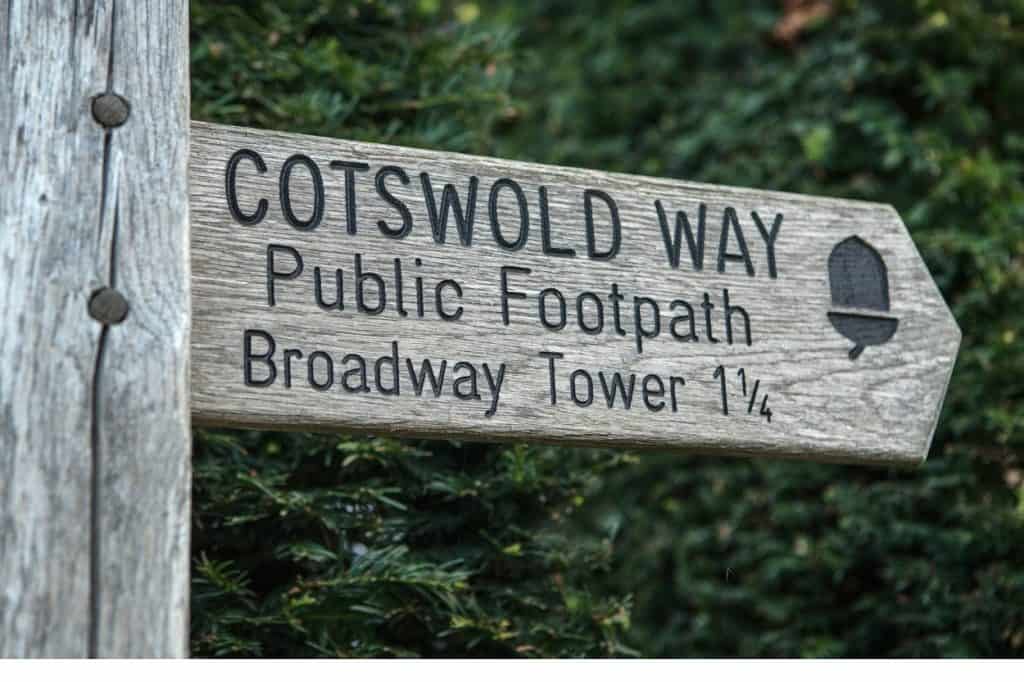
This is one of the most celebrated sections of the Cotswold Way and a fantastic standalone day walk. The route heads out of Chipping Campden, climbs to the top of Broadway Hill, and passes Broadway Tower before descending into the charming village of Broadway.
The first section offers a genuine challenge with some steep climbing. However, once you reach the top the rest is fairly easygoing with sweeping views across the surrounding countryside as your reward.
You have two options here depending on your energy and time. The point-to-point version takes you from Chipping Campden straight into Broadway at 6.1 miles. The loop version returns you to Chipping Campden through fields and woodlands, adding another 4 miles and some significant elevation gain. Both options end or pass through Broadway, where there are plenty of spots to stop for refreshments.
According to AllTrails reviews, the beautiful views, well-marked paths, and enjoyable scenery are the biggest highlights of this walk. That said, come prepared for steep climbs, occasional road walking, and the possibility of crowds at peak times. A waterproof jacket and sturdy footwear are non-negotiable on this one.
Find the point-to-point route on AllTrails here.
Find the loop route on AllTrails here.
Good to Know: Since this is a point-to-point route you will need a way back to Chipping Campden from Broadway. Local bus services connect both towns. Check timetables at National Public Transportation Information before you head out.
Chipping Campden and Dovers Hill
Distance: Short circular | Difficulty: Moderate | Est. Time: 1.5 to 2 hours
If you want a shorter walk that heads north out of Chipping Campden rather than south toward Broadway, the Dovers Hill circular is a great option. Dovers Hill is one of the most dramatic viewpoints in the northern Cotswolds and the site of the annual Cotswold Olimpick Games, a tradition dating back to the early 1600s.
According to AllTrails reviews, great views and varying terrain are the biggest highlights. However, similar to the Broadway route, steep climbs and some road walking are part of the deal. Start early and bring food and water.
Find the full route on AllTrails here.
Walking Near Broadway
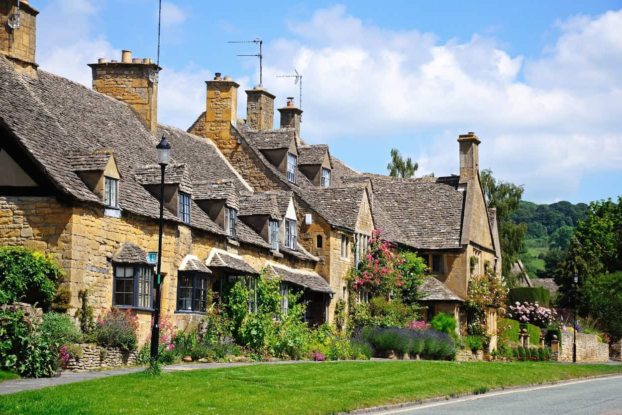
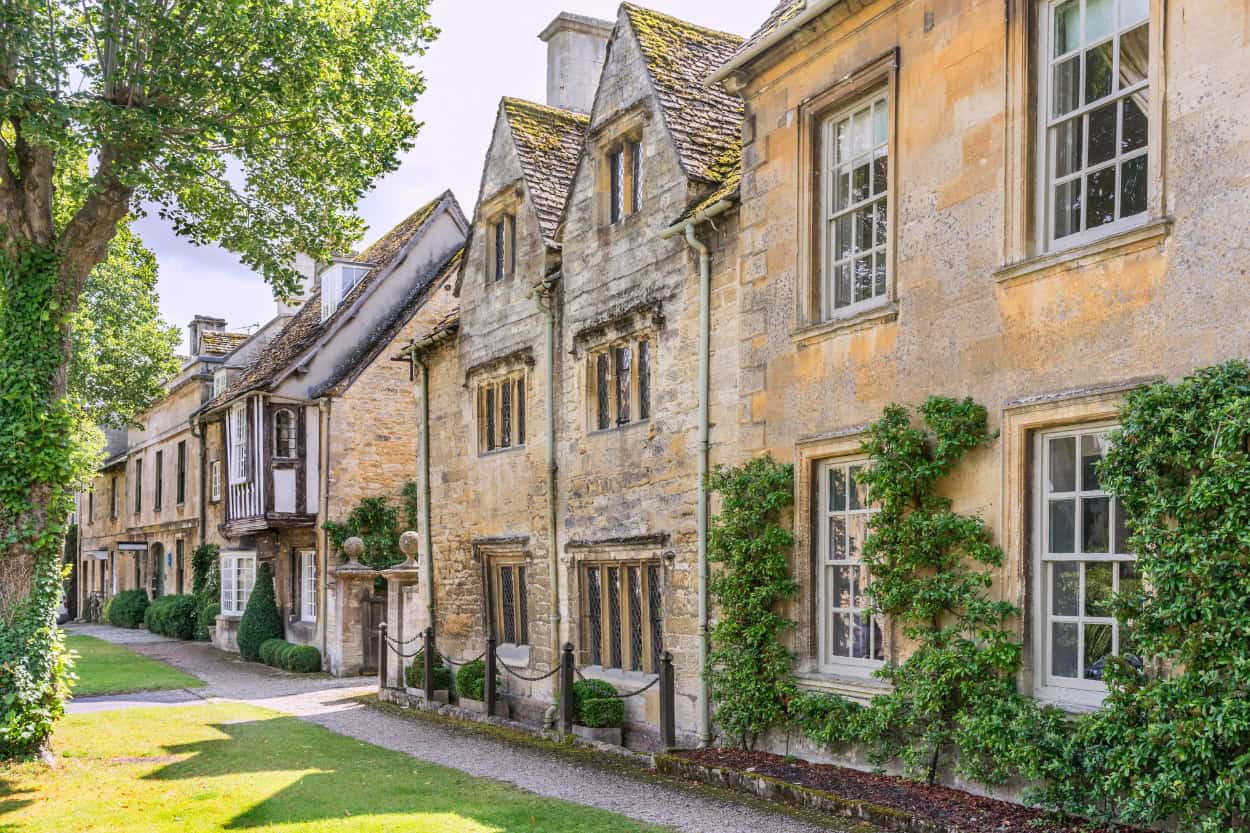
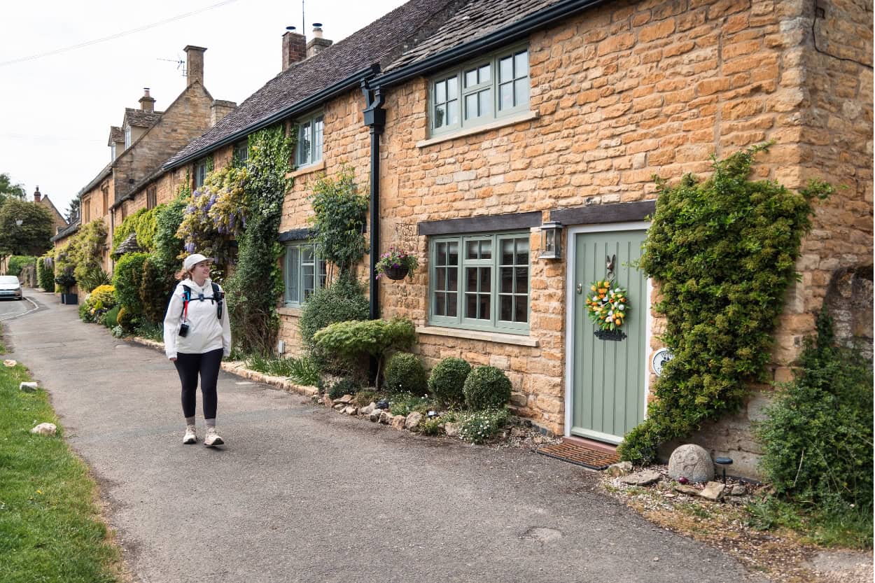
Broadway is one of the most photographed villages in the Cotswolds and it is easy to see why. A broad, tree-lined high street flanked by honey-colored stone buildings and independent shops makes it one of those places you wander through slowly.
Walking near Broadway offers some of the best elevated walking in the entire region. Furthermore, Broadway Tower sits high on the hill above the village and is the star of almost every walk based here.
Broadway Tower Circular
Distance: 4.6 miles | Difficulty: Easy to Moderate | Est. Time: 2.5 to 3 hours
The classic Broadway walk. The trail climbs to Broadway Tower, an 18th-century folly at over 1,000 feet, before looping back through stunning countryside. Reviewers love the views and the coffee shop midway through. Come prepared for mud and wear waterproof boots.
Find the full route on AllTrails here.
Broadway, Tower, Snowshill and Stanton Circular
Distance: 9.4 miles | Difficulty: Moderate | Est. Time: 5 to 5.5 hours
A longer day out that adds the villages of Snowshill and Stanton to the Broadway Tower loop. Nearly 1,830 feet of elevation gain makes this a serious walk. Start early, bring water, and wear sturdy footwear. Find this route on AllTrails here.
Find the full route on AllTrails here.

Walking Near Burford
Burford is one of the southern Cotswolds’ most charming market towns, with a steep high street of medieval stone buildings tumbling down toward the River Windrush. It sits just inside Oxfordshire and is often overlooked in favor of the more famous northern villages. However, the walking here is excellent and the town itself is well worth a few hours of your time.
Cotswolds and Burford Circular
Distance: 6.1 miles | Difficulty: Easy to Moderate | Est. Time: 2.5 to 3 hours
The best full day walk based out of Burford. The route takes you through the medieval town, out into rural farmland, and returns along a lovely stretch of the River Windrush. Relatively flat throughout with just a few gentle gradients.
Reviewers highlight the beautiful views, varied terrain, and peaceful countryside experience. That said, muddy paths and some flooding are recurring challenges, particularly in wetter months. Waterproof boots and an early start are strongly recommended.
Find the full route on AllTrails here.
Burford Town Circular
Distance: 1.7 miles | Difficulty: Easy | Est. Time: 30 to 60 minutes
Perfect for a short leg-stretch before or after exploring the town. This quick loop takes you from the bustle of Burford’s high street into quiet fields before returning through the historic town center. You may even spot some classic Cotswold sheep along the way.
According to AllTrails reviews, the beautiful views, varied terrain, and peaceful countryside experience are the biggest highlights. That said, muddy paths and some flooding are recurring challenges, particularly in wetter months. Waterproof boots and an early start are strongly recommended.
The Ultimate England Google Map
Planning a trip to England? We put together a custom Google Map with all of our favorite spots across the country, including everything we covered in this guide. Hotels, restaurants, attractions, hidden gems and more — all pinned and ready to go.
Walking Near Bibury
Bibury is one of those villages that stops people in their tracks. William Morris famously described it as the most beautiful village in England, and the crowds that show up every day suggest plenty of people agree.
Arlington Row, a stunning line of honey-colored weavers’ cottages dating back to the 14th century, is so iconic that an artist’s impression of it appeared in UK passports for years. The walking here follows the River Coln through some of the quietest and most beautiful countryside in the southern Cotswolds.
Bibury and Bibury Court Estate Circular
Distance: 4.1 miles | Difficulty: Easy to Moderate | Est. Time: 2 to 2.5 hours
A lovely circular route that takes you past Arlington Row, along the River Coln, and out into the rolling hills of the Bibury Court Estate. Several gentle gradients but nothing too steep. No stiles on this one, just a few gates and steps.
Reviewers highlight the beautiful countryside views, quiet routes away from the tourist crowds, and good wildlife spotting opportunities. Muddy trails in wet weather are the main challenge.
Find the full route on AllTrails here.
Bibury and Ablington Circular
Distance: 5.1 miles | Difficulty: Easy to Moderate | Est. Time: 2.5 to 3 hours
A slightly longer option that extends the Bibury loop out to the quiet village of Ablington and back. The route follows the peaceful River Coln throughout, with honey-colored cottages and ancient stone walls at every turn. Keep an eye out for kingfishers and wagtails along the water.
According to AllTrails reviews, the beautiful countryside views, quiet routes away from the tourist crowds, and good wildlife spotting opportunities are the biggest highlights. Muddy trails in wet weather are the main challenge.
Find the full route on AllTrails here.
Walking Near Winchcombe
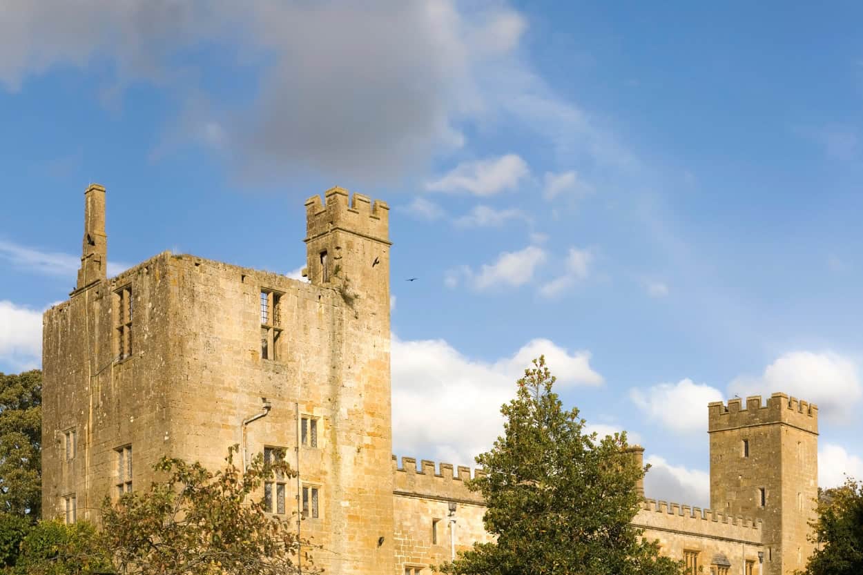
Winchcombe is one of the most underrated bases for walking in the Cotswolds. A charming medieval market town with independent shops, a strong local community, and Sudeley Castle right on its doorstep, it sits perfectly between the gentler southern Cotswolds and the dramatic high ground of Cleeve Hill.
Furthermore, it falls right on the Cotswold Way, making it a natural starting point for one of the best sections of the entire trail.
Cotswold Way: Winchcombe to Cleeve Hill
Distance: 5.7 miles | Difficulty: Moderate | Est. Time: 3 to 3.5 hours
This is one of the most dramatic sections of the Cotswold Way. The route heads out of Winchcombe through the grounds of Sudeley Castle before climbing steadily to Cleeve Hill, the highest point in the entire Cotswolds at over 1,000 feet. The views from the top stretch across the Severn Vale toward the Malvern Hills and on a clear day all the way to Wales.
Reviewers consistently highlight the gorgeous views and classic English countryside throughout. Steep climbs and icy conditions in winter are the main challenges. Start early and carry enough water as natural sources are limited on the limestone upland. Find this route on AllTrails here.
Good to Know: Since this is a point-to-point route you will need to arrange a way back to Winchcombe from Cleeve Hill. Both the start and end points are accessible via local bus services connecting to Cheltenham and Evesham. Check timetables at National Public Transportation Here before you head out so you are not left stranded at the top of the highest point in the Cotswolds.
Find the full route on AllTrails here.
The FREE Cotswolds Packing Guide
Not sure what to pack for walking the Cotswolds? We put together a free packing guide covering everything you need on the trail and at the hotel, from merino wool base layers to the exact shoes we wore. Download it and show up prepared.
Winchcombe and Cleeve Common Circular
Distance: 9.3 miles | Difficulty: Moderate | Est. Time: 4.5 to 5 hours
A longer loop that takes in farmland, woodland, and the dramatic open expanse of Cleeve Common before returning to Winchcombe. This route gives you all the elevation and views of the point-to-point version without needing to arrange transport at the other end.
Reviewers highlight stunning views and beautiful scenery throughout. One quirk worth noting: the trail crosses an active golf course at Cleeve Hill. Stay aware of your surroundings. Muddy sections and varying terrain are the other main challenges. Parking at the golf club or back lane car park is recommended if you are driving in. Find this route on AllTrails here.
Find the full route on AllTrails here.
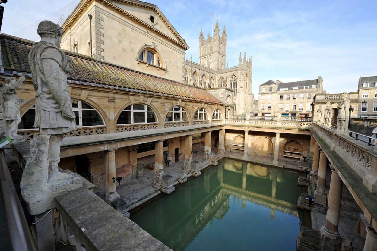
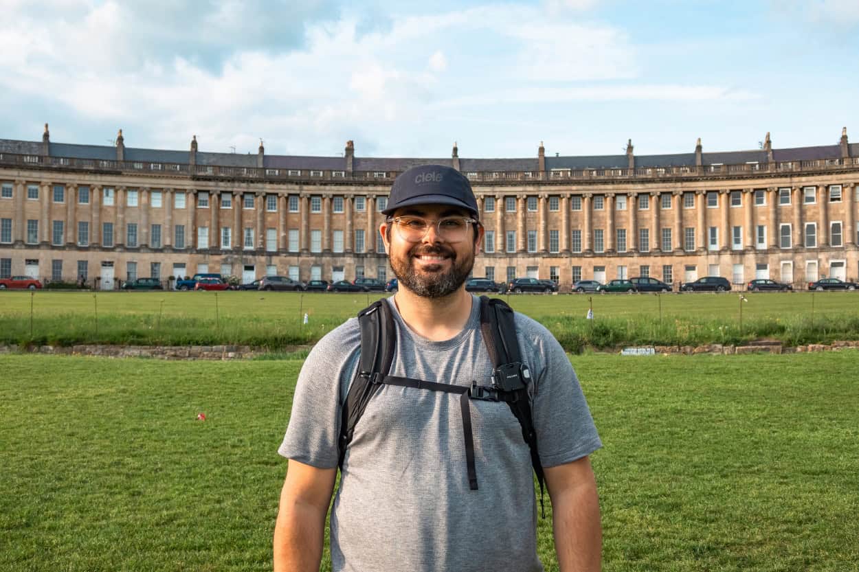
Walking in Bath
We absolutely loved Bath. It is one of those cities that stops you mid-sentence just to look around. Stunning Georgian architecture, thousands of years of history, and a energy unlike anywhere else we visited on our England trip. There is a reason it became a UNESCO World Heritage Site in 1987.
Our Macs Adventure tour drove us from Stow-on-the-Wold directly into Bath, skipping the few stages that connect Cheltenham down to the city. Honestly, that just gives us a reason to come back. The Macs Adventure 12-day Cotswold Way trip is looking better and better every day.

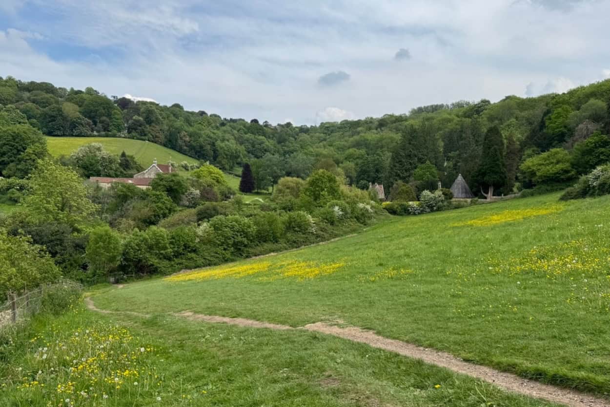
Bathwick and Claverton Down Circular (Bath Skyline)
Distance: 7.5 miles | Difficulty: Moderate | Est. Time: 3.5 to 4 hours
This was our walk in Bath and it offered significantly steeper terrain than anything we had experienced in the Cotswolds up to that point. The route winds out of the city, climbs through Bathampton Wood, loops around Claverton Down, and returns past St Mary’s Bathwick with sweeping views over the city throughout.
We did a portion of the route including a detour to the Palladian Bridge in the grounds of Prior Park, which was stunning. However, we cut the walk short that day. We had spent the previous day exploring Bath on foot and Katie was starting to feel under the weather. Adding another four miles did not make sense. Sometimes the smart move is knowing when to turn back.
One important note from AllTrails reviews: follow this route clockwise. The National Trust removed the counter-clockwise signs, which means going the wrong way will almost certainly get you lost. Furthermore, check Prior Park opening times before you head out as they vary throughout the year.
Beautiful views over the meadows and city, along with a nice mix of wooded trails, are the biggest highlights according to those who have walked it. Steep climbs, muddy paths, and some overgrown sections are the main challenges. Sturdy footwear and an early start are strongly recommended.
Find the full route on AllTrails here.
Cotswold Way: Cold Ashton to Bath
Distance: 10.4 miles | Difficulty: Moderate | Est. Time: 5 to 5.5 hours
This is the final stage of the Cotswold Way and one of the most rewarding. The route descends from the high ground of Cold Ashton, passes the site of the Civil War Battle of Lansdown, and arrives at the doors of Bath Abbey. There is no better way to finish the full trail than walking into one of England’s most beautiful cities on foot.
Reviewers praise the beautiful countryside and stunning views as the trail approaches Bath. Unexpected steep hills and limited facilities are the main challenges. Carry plenty of water and prepare for uneven terrain.
Find the full route on AllTrails here.
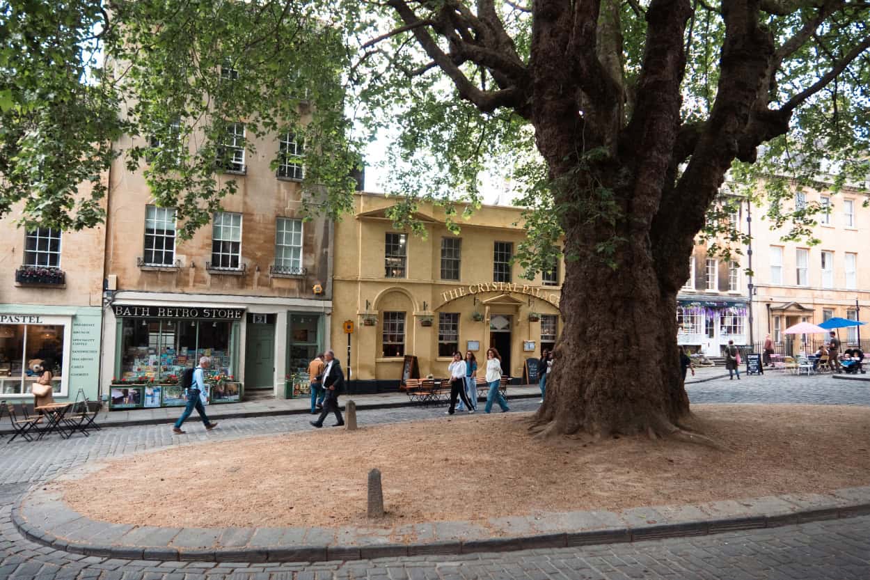
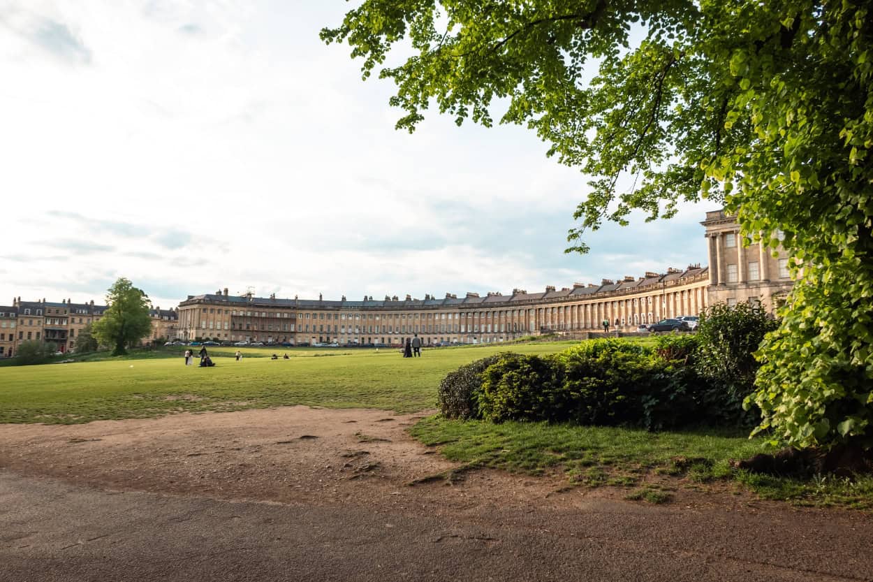
Historical Bath City Walking Tour
Distance: 2.2 miles | Difficulty: Easy | Est. Time: 30 to 60 minutes
Not every walk needs to be through countryside. This short city loop takes you past some of Bath’s most iconic landmarks including Queen Square, the Circus, the Royal Crescent, Pulteney Bridge, Bath Abbey, and the Roman Baths. It is the perfect introduction to the city before or after a longer trail day.
Reviewers highlight the amazing architecture, beautiful views, and excellent overview of city history. Start early to beat the crowds. We are going to write a lot about Bath in the future but until then, check out our Instagram Reel.
Find the full route on AllTrails here.
The Ultimate England Google Map
Planning a trip to England? We put together a custom Google Map with all of our favorite spots across the country, including everything we covered in this guide. Hotels, restaurants, attractions, hidden gems and more — all pinned and ready to go.
How To Plan Your Cotswolds Walking Trip
Planning a trip to the Cotswolds does not have to be complicated. However, there are a few decisions you will want to make before you go that will shape your entire experience. The biggest questions most people have are around accommodation, luggage, and whether to go it alone or book through a tour operator.
Here are your three main options.
Plan Your Cotswolds Walking Trip Yourself
The most flexible approach and the most work. You choose your own route, book accommodation in each town along the way, and arrange everything independently.
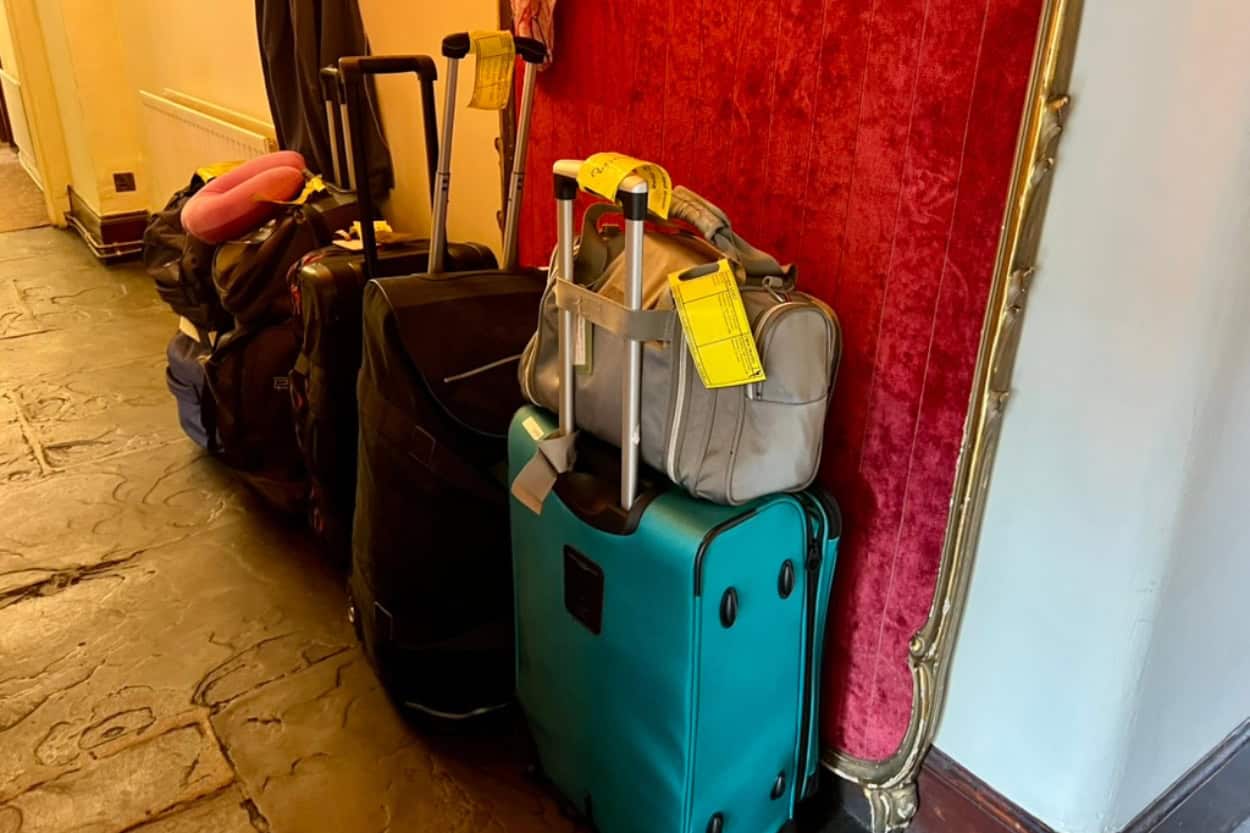
For luggage transfers, Sherpa Van or CarryABag are highly rated and the most well-known services for point-to-point bag delivery along walking routes in the UK. You book online, leave your bag at your accommodation in the morning, and it meets you at your next stop. Simple and straightforward.
Just do not underestimate how quickly accommodation fills up in peak season, especially in the smaller villages. Book early. This is not a destination where you can show up and figure it out.
Need Help Planning?
We offer 30-minute travel planning sessions where you can ask us anything and leave with a clear plan for your trip.
Book a Supported Walking Tour Through the Cotswolds
This is what we did and we would do it again without hesitation.
There are many companies that specialize in self-guided walking holidays throughout the Cotswolds. We were hosted on ours through Macs Adventure. Not only do they offer multiple routes across England, they operate trips all over the world and have been doing this for almost 30 years. That experience shows in every detail of the trip.
You select your route and date and they handle everything else. Every single hotel booking along the way is taken care of. No hours spent cross-referencing dates, no spreadsheet of confirmation numbers, no stress about whether the next town even has availability. You just show up, open the app, and follow the route to your next hotel.

On top of that, a delicious breakfast was included at every hotel along the route. We are talking fantastically fluffy French toast all the way to a full English breakfast. Truly great options every single morning. Furthermore, as we mentioned earlier, that breakfast is dangerous for your start time. Do not say we did not warn you.
Luggage Transfers Are The Unsung Hero
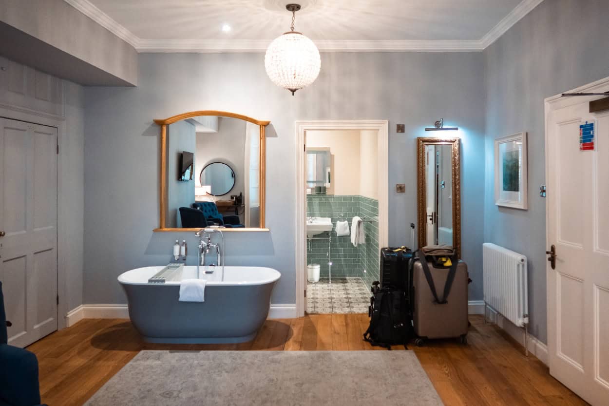
Every accommodation is selected to fit the route, which means you are always in the right town at the right time. Your luggage is transferred between stops each morning as well. Leave your bag at the hotel by 8:30am and it will be waiting at your next destination before you arrive. On the mornings we missed that window there was always a second pick-up a few hours later. Our bags still beat us to the next town every single time.
We showed up. We walked. We did not have to think about anything else. For anyone who wants the full experience without the logistical headache, we cannot recommend Macs Adventure enough.
Base Yourself in One Town and Day Hike the Cotswolds
If you would rather keep things simple and not deal with moving accommodations at all, this is a fantastic option. Pick one town as your base, settle in for a few nights, and explore the surrounding countryside on day hikes. You get all the beauty of walking the Cotswolds without any of the logistical complexity of moving between towns.
Three towns that work particularly well as a base:
- Bourton-on-the-Water sits at the center of the region with excellent circular routes right on its doorstep. It is one of the most popular villages in the Cotswolds and has a good range of accommodation options.
- Stow-on-the-Wold sits at 800 feet and offers easy access to some of the best walking in the northern and central Cotswolds. We based ourselves here during our trip and loved every minute of it.
- Moreton-in-Marsh is the most accessible town in the region by train and makes a great starting point if you are arriving from London or Oxford. Furthermore, several excellent day walks start right from the town center.
Whichever town you choose, booking early is essential. Head to our Where To Stay When Walking The Cotswolds section below for our specific hotel recommendations across all three towns.
Best Time Of Year To Walk The Cotswolds
The Cotswolds can technically be walked year-round. However, when you go will shape your experience significantly. Here is an honest breakdown of each season to help you decide.
Walking the Cotswolds in Spring (March to May)
We walked the Cotswolds in May and the conditions were ideal. The countryside was green and alive, English bluebells lined the shaded paths, and the villages felt busy but not overwhelming. Temperatures average around 52 to 59 degrees Fahrenheit (11 to 15 degrees Celsius), which is perfect walking weather (in our oppinion).
That said, the very week we flew home the Cotswolds were hit with record breaking heat, which is extremely rare for England. Therefore, always check the forecast before you go regardless of when you travel. England’s weather has a way of surprising you.
Spring does come with mud. The paths can get wet and boggy, particularly in March and April. Waterproof boots are non-negotiable. May is generally the driest spring month and falls nicely between the Easter rush and the peak summer crowds. Furthermore, enough walkers have been through ahead of you by late spring that natural tracks are worn into the grass, making navigation significantly easier.

Walking the Cotswolds in Summer (June to August)
Summer brings the warmest temperatures and the most daylight hours, reaching 68 to 77 degrees Fahrenheit (20 to 25 degrees Celsius), occasionally higher. However, it also brings the crowds. July and August are peak tourist season in the Cotswolds and the most popular villages, Broadway, Bourton-on-the-Water, and Bath in particular, get extremely busy. Furthermore, accommodation books up fast and prices are at their highest.
Therefore, if you are walking in summer, book everything well in advance and start your days early to beat the crowds on the trail and in the villages. Everything you need to book is right here.
Everything You Need to Plan Your Trip
- ✈️ Flights: We use Daily Drop to find the best flight deals and mistake fares.
- 🚂 Trains and Buses: We book all of our transportation through OMIO.
- 🚗 Car Rental: We use Booking.com to compare the best rates.
- 🏨 Hotels: We use Booking.com and VRBO to find the best accommodation for every trip.
- 🏢 Hostels: We use Hostelworld to find the best budget stays.
- 🗺️ Tours and Activities: We book all of our tours through GetYourGuide and Viator.
- 🛡️ Travel Insurance: We never travel without it, SafetyWing.
- 📱 eSIM: We use Saily for all of our data needs.
- 📚 Guidebooks: Rick Steves and Lonely Planet.
- 💳 Travel Credit Card: We use the Capital One Venture X for all of our travel purchases. It comes with automatic trip cancellation, lost luggage, and travel accident insurance built in.
Walking the Cotswolds in Autumn (September to November)
Honestly, autumn might be our next choice for walking the Cotswolds. September and October bring rust-colored leaves and crisp air that makes every mile feel a little more rewarding. Temperatures range from 46 to 59 degrees Fahrenheit (8 to 15 degrees Celsius). In addition, the summer crowds have cleared out, accommodation prices drop, and the villages feel more like themselves again.
October is generally the drier of the two months. However, November can get foggy and damp, though in a very atmospheric, mist-over-the-fields kind of way. Once the clocks go back at the end of October, daylight hours shorten significantly. Therefore, you will need to be at your destination by around 4:30 to 5pm to avoid walking in the dark. Plan your daily mileage accordingly.
Walking the Cotswolds in Winter (December to February)
Winter is for the hardiest of walkers. Temperatures can drop to 34 to 43 degrees Fahrenheit (1 to 6 degrees Celsius) and the paths can be icy and unpredictable. Furthermore, some accommodation and luggage transfer services along the route operate on reduced hours or close entirely. Heavy snowfall can make trail conditions genuinely challenging.
That said, there is something undeniably beautiful about the Cotswolds in winter. The villages are quiet, prices are at their lowest outside of the Christmas period, and a crisp clear winter day on the escarpment offers some of the best views of the entire year. However, with fewer walkers on the trail, the natural grass tracks disappear. Therefore, navigation becomes harder and getting lost becomes easier. Come prepared with a solid navigation app and do not rely on worn paths to guide you.
What To Pack For Walking The Cotswolds
Packing for walking the Cotswolds is all about being prepared for everything while keeping your bag as light as possible. The weather will change, the terrain will vary, and your feet will thank you for every good decision you made before leaving home.
A few non-negotiables worth calling out:
- Sturdy walking shoes or hiking boots are essential regardless of the season. The paths get muddy and wet conditions can appear out of nowhere. We both opted for trail running shoes, which gave us extra grip and a comfortable sole throughout the trip. Whatever you choose, make sure they are broken in before you go. Blisters on day one are not a good start.
- A proper waterproof jacket is equally important. Not water resistant. Waterproof. There is a difference and you will feel it the moment the rain starts.
- Merino wool is our single biggest recommendation for multi-day walking. It wicks moisture, regulates temperature, resists odor after multiple wears, and feels comfortable all day. For a trip where laundry is not always an option, it is genuinely a game changer.
- A daypack is all you need on the trail each day if you are using luggage transfers. Keep it light. Water, snacks, camera gear, a battery pack, and a rain layer is all you need.
For the full packing list including everything we wore and carried on our trip, grab our free Cotswolds Packing Guide below.
The FREE Cotswolds Packing Guide
Not sure what to pack for walking the Cotswolds? We put together a free packing guide covering everything you need on the trail and at the hotel, from merino wool base layers to the exact shoes we wore. Download it and show up prepared.
Where to Stay when Walking The Cotswolds
Accommodation along the Cotswolds fills up fast, particularly in peak season. The smaller villages have limited options and the best places book out weeks if not months in advance. Our advice is simple. Once you know your route and dates, book your accommodation immediately. Do not leave it until the last minute.
For most walkers, a mix of traditional inns, B&Bs, and small hotels is the norm along the route. Most include breakfast, which as we mentioned earlier is both a highlight and a hazard for your morning start time.
If you are booking independently, prioritize staying in the town center rather than on the outskirts. After a long day on the trail the last thing you want is an extra mile to your front door.

Bath
Technically just outside the Cotswolds, Bath is the perfect bookend to any trip through the region. A UNESCO World Heritage city with Roman baths, Georgian architecture, incredible food, and a buzzing city energy that feels earned after days of quiet countryside walking.


Bourton-on-the-Water
Known as the Venice of the Cotswolds thanks to the River Windrush flowing through the center of the village and a series of low stone bridges crossing it. One of the most photographed villages in England and a fantastic base for day hiking.
- The Dial House Hotel
- Old Manse Hotel
- Chester House Hotel
- Browse all Bourton-on-the-Water accommodation
Broadway
Often called the jewel of the Cotswolds, Broadway is a picture-perfect village with a wide tree-lined high street and some of the most charming architecture in the region.
Cheltenham
A grand Regency spa town sitting just off the escarpment. The largest town on or near the trail and the easiest place to find last minute accommodation if needed.
Chipping Campden
The official starting point of the Cotswold Way and one of the most beautiful towns in the entire region. The high street is lined with honey-stone buildings dating back hundreds of years and the surrounding countryside is stunning.
Dyrham
A quieter market town with great access to the escarpment and dramatic countryside views.
Hawkesbury Upton
A small village marking the entry into South Gloucestershire.
Moreton-in-Marsh
One of the best entry points into the Cotswolds, especially if you are coming by train from London or Oxford. A proper working market town with a long high street and easy access to the surrounding countryside.
Old Sodbury
A quiet village with an ancient hill fort nearby.
Painswick
Known as the Queen of the Cotswolds, Painswick is a hilltop town with narrow winding streets, a stunning churchyard, and some of the best views in the region. A little more off the beaten path, which makes it all the more special.

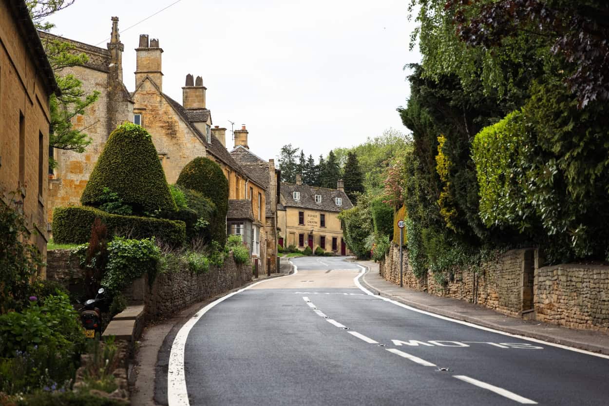
Stow-on-the-Wold
A hilltop market town with ancient streets, antique shops, and some of the best walking in the region. It sits at a natural crossroads and is one of the most visited towns in the Cotswolds for good reason.
Stroud
A characterful market town set in a valley surrounded by five converging hills.
Winchcombe
A quieter, less touristy town that deserves far more attention than it gets. Sudeley Castle sits right on the edge of town and the walking is fantastic.
Wotton-under-Edge
A historic market town on the southern edge of the Cotswolds.

FAQ: Walking The Cotswolds
Where are the Cotswolds located?
The Cotswolds is a region of rolling hills, honey-stone villages, and open countryside in south-central England. It spans parts of Gloucestershire, Oxfordshire, Warwickshire, Wiltshire, and Worcestershire, covering roughly 800 square miles.
Furthermore, it was designated a National Landscape, previously known as an Area of Outstanding Natural Beauty, in recognition of its exceptional scenery.
What are the major cities near the Cotswolds?
The Cotswolds sits within easy reach of several major cities, which makes it simple to plan a visit. London is about two hours away by train or car. Additionally, Bath, Bristol, Oxford, and Cheltenham all sit on or near the edges of the region, with Birmingham not far beyond that to the north.
What is the biggest city in the Cotswolds?
Cheltenham is the largest town in or near the Cotswolds, though it sits just on the edge of the region rather than within its core. Within the Cotswolds itself, Bath is the largest and most significant city, despite technically sitting just outside the official boundary. For a true Cotswolds market town experience, Stroud and Cirencester are the largest towns within the National Landscape boundary itself.
What currency is used in the Cotswolds?
The currency used throughout the Cotswolds is the British Pound (GBP). Most hotels, restaurants, and shops accept major credit cards. However, it is worth carrying some cash for smaller purchases, rural pubs, and farm stalls along the trail where card readers are not always available.
Is there cell phone reception in the Cotswolds?
Cell phone reception in the Cotswolds is generally good in the towns and villages but can be patchy in more remote stretches of the trail. Before every international trip we pick up a Saily eSIM, which gives us reliable data coverage without the roaming charges. Download your route offline before you head out and, on top of that, consider a battery pack to keep your phone charged throughout the day.
What is the best way to walk the Cotswolds?
The best way to walk the Cotswolds depends entirely on your time, fitness, and travel style. The full Cotswold Way covers 102 miles over 7 to 12 days, while day hikes and circular routes let you explore the region at a more relaxed pace. Furthermore, booking through a supported tour operator like Macs Adventure takes care of accommodation and luggage so you can focus entirely on the walking.
Do I need travel insurance for the Cotswolds?
Yes, we always recommend travel insurance for any international trip including the Cotswolds. A good policy will cover trip cancellations, medical emergencies, and lost or stolen gear. We use SafetyWing for health insurance and VisitorsCoverage for travel insurance during our travels and have found it to be reliable and straightforward.
Who is walking the Cotswolds for?
Walking the Cotswolds is for anyone who loves being outdoors, exploring history, and experiencing one of England’s most beautiful landscapes on foot. The trails range from easy flat walks suitable for beginners to longer more challenging routes for experienced hikers. In short, whether you are a seasoned long-distance walker or someone looking for a gentle introduction to walking holidays, the Cotswolds has something for you.
Do you have to be fit to walk the Cotswolds Way?
You do not need to be an elite athlete to walk the Cotswolds Way, but a reasonable base level of fitness will make the experience significantly more enjoyable. Most stages average around 10 miles per day with moderate elevation gain. That said, we recommend building up your daily mileage in the months before your trip and breaking in your footwear well in advance.
What happens if you cannot make it to your next destination when walking the Cotswolds?
Do not panic! The Cotswolds is well connected by local bus services, taxis, and sometimes trains, meaning help is never far away. The Pulhams 801 bus connects several key towns including Moreton-in-Marsh, Stow-on-the-Wold, and Bourton-on-the-Water.
Additionally, if you book through Macs Adventure their support team is available to help rearrange accommodation and logistics if your plans change on the trail.
What amenities are available on the Cotswolds trails?
One of the great joys of walking the Cotswolds is that you are never far from a village, which means food, water, and facilities are generally close at hand. Most villages have at least one pub or cafe where you can stop for lunch and refill your water bottle. However, on longer stretches between towns it is always worth carrying snacks, at least two liters of water, and some cash for smaller stops that do not take cards.
What is the best app for walking the Cotswolds?
If you are booking a supported self-guided tour through Macs Adventure, their app loads your exact route and updates in real time making it the most seamless navigation option available. For independent walkers, AllTrails has a solid selection of Cotswolds routes with reviews and offline download capability. In addition, the National Trail website is an excellent free resource for Cotswold Way specific navigation and route planning.
How do I navigate the Cotswolds trails without getting lost?
Like This Post? Pin It for Later!
Planning a trip to the Cotswolds? Save this guide to your travel board so you can find it when you need it most.